
Nature Conservation 2025 — 31. 7. 2025 — Research, Surveys and Data Management — Print article in pdf
Project Mapping and Species Inventories (Monitoring 2) Has Been Completed
The Nature Conservation Agency of the Czech Republic (NCA CR) is tasked with monitoring the condition of habitats and species, which can broadly be referred to as biodiversity monitoring. The monitoring and mapping of species and habitats significant for the European Union, which serve to fulfil the reporting obligations under EU directives, are funded by the state budget. However, the data collection needs are broader, and to meet them, the NCA CR proposes and manages a range of projects. The most extensive in terms of both objectives and funding are financed by the Operational Programme Environment.
Between 2010 and 2015, the first such project was implemented, entitled as Monitoring and nationwide mapping of species of European importance for the completion of the Natura 2000 network proposal in the Czech Republic, abbreviated as Monitoring and mapping of SEIs. Its core content was the detailed and extensive mapping of selected wild animal species across the Czech Republic, which commenced in 2012. The project included the mapping and monitoring of species significant for the EU: crayfish; molluscs; beetles; butterflies and moths; dragonflies and damselflies; grasshoppers, locusts and crickets; mapping of selected fish species, amphibians, and reptiles, selected mammal species, and the mapping of bird species listed in Annex I to the EU Birds Directive. The mapping was carried out by 16 external contractors. At the same time, a similarly large-scale project called Implementation of the Natura 2000 Network in the Czech Republic was underway, the core content of which also involved data collection: inventory surveys in small-size Specially Protected Areas of national categories. These activities were also conducted out by a smaller number of competitively selected contractors; however, in the actual implementation of many surveys, it led to unwelcome compromises in quality. After the conclusion of both projects, it became evident that further fulfilment of the broad data collection and gathering needs regarding species would not be possible without a follow-up project; indeed, the then-current call under the Operational Programme Environment already anticipated more extensive funding for monitoring.
, Nature Conservation Agency of the Czech Republic")
Overall view of occurrence data gathered during the project. © Nature Conservancy Species Occurrence Finding Data Database (NCSOFDD), Nature Conservation Agency of the Czech Republic
As early as 2015, the NCA CR’s Department of Biodiversity Monitoring developed a proposal substantively combined both topics: the project Mapping & inventory, officially titled Monitoring and mapping of selected plant and animal species and inventory of small-size Specially Protected Areas in nationally important areas in the Czech Republic. By combining both major topics, the project once again surpassed the previous volume and financial records of the NCA CR (the total proposed project budget reached nearly CZK 360 million = EUR 14.5 million), while also bringing significant organisational and formal challenges.
Based on experience from previous projects, most fieldwork was carried out through part-time job agreements. In total, more than 2,100 such agreements were concluded within the project. While the agreements come with several limitations, they offer a key advantage: the ability to directly select and control the quality of contractors without intermediaries.
 is one of the more difficult species to be detected during reptile surveys. Even a shed skin can serve as evidence of its presence at a site. © Zdeněk Mačát")
The Smooth snake (Coronella austriaca) is one of the more difficult species to be detected during reptile surveys. Even a shed skin can serve as evidence of its presence at a site. © Zdeněk Mačát
The project consisted of two main components, effectively the successors and continuations of the previous projects: (1) mapping and (2) inventory surveys. Mapping in this project also included plants, but it could only be conducted within protected areas: Protected Landscape Areas (PLAs), National Parks (NPs), Sites of European importance (SEIs, pursuant to Act No. 114/1992 on Nature Conservation and Landscape Protection, as amended later, the term for Site of Community Importance, SCIs, later Special Area of Conservation, SACs, under the European Union’s Habitats Directive), and Bird Areas (Bas, pursuant to the above act, the term for Special Protection Area, SPAs under the EU Birds Directive). Inventory surveys, on the other hand, focused primarily on non-national small-size Specially Protected Areas (SSPAs) managed by the NCA CR – an extensive set of sites that had not yet been addressed. In addition, surveys were also carried out in National Nature Monuments and National Nature Reserves where they had previously been lacking and were required by the site management planning cycle. For the mapping and monitoring of fish, bats, and birds, the model of external contracts was retained, with these contracts being subject to public tenders. Due to the specialised nature of the activities, the contractors are entities with extensive experience and qualified experts: the Academy of Sciences of the Czech Republic, Czech Bat Conservation Society, and Czech Society for Ornithology. For the other groups, the activities were carried out by employees, both through part-time job agreements and by regional staff who were funded by the project. The project plan aimed to conduct monitoring at 14,790 sites and carry out 5,070 inventory surveys, including 50 surveys in the Prague territory (which had to be financed from other NCA CR sources). The combination of both activities led to greater survey efficiency. If an inventory survey for the relevant group was conducted within a given mapping unit, it was removed from the mapping plan. In essence, mapping complemented the inventory surveys in areas that were not covered by protected areas.
. It has been confirmed in several species surveys conducted as part of the project. © Zdeněk Chalupa")
White Carpathians Mts. are the centre of occurrence for the rare Sage tortoise beetle (Cassida canaliculata). It has been confirmed in several species surveys conducted as part of the project. © Zdeněk Chalupa
All the data gathered was stored and made accessible in the Nature Conservancy Species Occurrence Finding Data Database (NCSOFDD), where it is available to, among others, all State Nature Conservancy authorities. Due to the scale of the project, the volume of findings gathered has also been very high. In the NCSOFDD, two projects were established to consolidate the collected data – OP MapInv: Inventory of SSPAs, and OP MapInv: Monitoring and mapping of selected species. Both datasets are among the largest, with a total exceeding 925,000 records, nearly ten times the amount of data from the previous, more narrowly focused project Monitoring and Mapping (just under 93,000 records).
What was achieved in the project will be presented by individual species groups; many of the partial results will be published as articles in the Příroda journal issued by the NCA CR.
Mosses, lichens, and fungi
The “non-vascular” groups were always somewhat neglected in standard status monitoring, and the MapInv project provided a significant financial boost for surveys focused on them. The aim of mapping and monitoring was to focus on species from the Red List of Threatened Species of the Czech Republic, particularly those threatened by inappropriate management (e.g. rare forest epiphytes) or its absence (e.g. species of fen bogs and peatbog grasslands), relict species (e.g. Arctic-alpine species of glacial cirques/corries and snowfields), or rare, newly confirmed species. The distribution, condition, and population size of these species were assessed. For mosses and lichens, species significant for selected habitats were also mapped, including those found in: fields and stubble; mountain Norway spruce forests, sandstone rock cities, beech forests, steppe grasslands, limestone rocks, mires, glacial cirques/corries and snowfields, wind-swept alpine grasslands and alpine heathlands, fens, springs, watercourses, sandy areas, scree, relict pine forests, heathlands, oak forests, floodplain/alluvial forests, diabase and serpentinite outcrops, rocks rich in heavy metals, and the exposed bottoms of fishponds. Unfortunately, the financial boost encountered limitations due to unavailable capacity. Mycological surveys are very demanding, and the capacity of Czech mycologists was quickly exhausted. As a result, a significant portion of the planned surveys was not carried out, and the funds could not be utilised.
Vascular plants
The project set the goal of obtaining high-quality information about the most endangered group of vascular plants in order to propose optimal conservation measures for them. Once again, the project increased the resources dedicated to monitoring species, focusing on those significant for the EU. The critically endangered vascular plant species from the Red List of Vascular Plants of the Czech Republic were mapped, supplemented by Specially Protected Species (excluding those with an approved action plans/recovery programme). Quantitative population parameters were determined, along with data on the condition of the species and its habitat, including the recording of phytocoenological relevés.
Invertebrates
Large branchiopods, notable crustaceans, were mapped in grids of the network covering most of the large-size Specially Protected Areas (i.e. NPS and PLAs) and BAs. Aquatic molluscs were surveyed in 100 grid squares within selected PLAs, while terrestrial molluscs were surveyed in a different set of 100 grid squares. Targeted monitoring focused on potential and current sites of the Lesser ramshorn snail (Anisus vorticulus) and the whorl snails Vertigo moulinsiana and V. angustior, which are significant indicator species.
In the case of insects, the project mapped beetle communities in 592 second-order grid squares (provisionally referred to as quarter-quadrants). Depending on the habitat type, the focus was on saproxylic species groups (in forested areas) or phytophagous ones (in open habitats), while epigeic species were always surveyed. Due to limited expert capacity, results were submitted for only 400 grid squares by the end of the project. A total of 638 second-order grid squares within the PLAs were surveyed for orthopterans as well. Butterflies were also mapped in the same area, using both intensive (16 sites per grid square) and extensive (4 sites per grid square) survey methods. Based on the results of intensive mapping of butterflies in the PLAs, a thematic issue of the Příroda journal was compiled (published in the first quarter of 2024). This publication complements a series of regional butterfly distribution atlases that have been published in the Czech Republic in recent years. This series is probably unique on a global scale. Dragonflies and damselflies from the aquatic groups were surveyed across 600 grid squares; unfortunately, due to a lack of experts, only slightly over 400 grid squares were processed by the end of the project, as was the case with the beetles.
Vertebrates
The project included a repeat of the nationwide mapping of amphibians and reptiles, which has been conducted by the NCA CR since 2008, with the first phase completed in 2014 as part of the initial monitoring project. The established methodology was used to confirm the current occurrence of each species in every quarter-quadrant of the surveyed grid square, again within PLAs. The inventory of amphibians and reptiles further supplemented this mapping. In addition to mapping, the recent occurrence of amphibians and reptiles was confirmed in selected SEIs, using available resources.
In the case of fish, the availability of data is the result of the long-term efforts of the NCA CR to utilise various project resources to fill gaps in their knowledge. The need to update information on the population status of the fish species listed below is all the more crucial as these are mostly relatively short-lived species, and aquatic ecosystems are continuously subjected to significant anthropogenic pressure, which is expected to have a negative impact on these species. The project supplemented and updated data on the populations of Specially Protected fish species within PLAs and SEIs. While in the past, the study on the distribution and demographic parameters of these species was the subject of scientific research, there are almost no such studies outside of conservation monitoring. At 50 sites, covering all SEIs (including Soutok/Confluence-Podluží SAC, the most significant SEI in terms of fish being a subject of conservation), endangered Ponto-Caspian species were monitored annually: the Streber (Zingel streber), Common zingel (Zingel zingel), Zinge (Pelecus cultratus), Danube ruffe (Gymnocephalus baloni), Striped ruffe (Gymnocephalus schraetser), Golden spined loach (Sabanejewia aurata), Ukrainian brook lamprey (Eudontomyzon mariae), Kessler’s gudgeon (Gobio kessleri), nad the White-finned gudgeon (Romanogobio albipinnatus). The population status in the SEIs was assessed twice for other European significant fish species: the Weatherfish (Misgurnus fossilis), loach (Cobitis sp.), Bitterling (Rhodeus sericeus), Asp (Leuciscus aspius), Common bullhead (Cottus gobio) and the Brook lamprey (Lampetra planeri). In addition, fish communities were mapped in selected PLAs, which was analogous to the mapping activities carried out for other groups. The aim was to capture long-term changes in abundance and any changes in the distribution of fish species listed under the EU Habitats Directive and species of special conservation concern.
The project included three activities focused on birds. It enabled the mapping to be focused on Specially Protected Species that had not previously been targeted, as well as species with a negative population trend and species that are difficult to detect or are conflict species. Thus, the focus of the surveyors in the PLAs included species such as the Little owl (Athene noctua), Black-headed gull (Chroicocephalus ridibundus), Northern lapwing (Vanellus vanellus), Black-tailed godwit (Limosa limosa), Common snipe (Gallinago gallinago), and the Grey heron (Ardea cinerea), grouped into seven methodological categories. In each grid square, an average of four methodologies were used for mapping.
Night-time acoustic monitoring (which is a time-efficient method) was conducted for selected species that are difficult to detect: all owl species, the Eurasian woodcock (Scolopax rusticola), Hazel grouse (Tetrastes bonasia), European nightjar (Caprimulgus europaeus), Great bittern (Botaurus stellaris), Little bittern (Ixobrychus minutus), Spotted crake (Porzana porzana), Little crake (Porzana parva), and the Corncrake (Crex crex). Monitoring is carried out using audio recorders in grid squares selected based on the analysis of data gaps and available personnel capacity.
In BAs, the population size of all species listed in Annex I to the Birds Directive was assessed once. The project thus allowed for the restoration of this monitoring type, which had been carried out from 2005 to 2013 but was subsequently discontinued due to a lack of funding and replaced by other methodological approaches in previous projects. The data gathered during the course of the project were used for reporting under the same Directive in 2019 and will also be used in the next reporting period in 2025. As in other cases, the application of the data is broad and contributes to the development of further monitoring activities after the project’s completion.

Recorder camouflaged in the field – acoustic bird monitoring using automatic recorders. © Jan Havelka
The range of activities for mammals was quite broad. Mammals, apart from those species that were subject to specific activities, were systematically mapped in the PLAs, many of which for the first time. Similar to the case with fish, systematic mammalogical studies were resumed after a long period, which would provide a complete overview of the mammal fauna in a specific area. Special attention was given to non-native carnivore species: the Raccoon dog (Nyctereutes procyonoides), Northern raccoon (Procyon lotor), and the American mink (Neovison vison) in the Krkonoše/Ginat Mts. National Park, where other mammal species were not mapped within the project.
For the Eurasian beaver (Castor fiber) monitoring was conducted every two years in all SEIs where the species is a subject of conservation (Kateřinský potok/Catherine’s Brookand Nivní potok/Floodplain Brook, Labe/Elbe River Valley, Strážnická Morava, Dyje/Thaya River floodplain, Soutok/Confluence-Podluží, Litovelské Pomoraví/Litovel Morava River Basin, Morava/Moravia – Chropyňský luh/Chropyně Floodplain). Due to the complexity of the monitoring, funding outside the state budget was necessary. Monitoring the spreading and colonisation of new sites as part of the occurrence mapping is crucial, especially considering that the presence of Eurasian beaver in recent years has often conflicted with the land-use by agriculture, forestry, and water management. Occurrence mapping and population monitoring of Eurasian beaver in SEIs are part of the planned activities of the Eurasian Beaver Management Programme in the Czech Republic, which was approved in 2013 by the Ministry of the Environment of the Czech Republic, with the NCA CR charged to implement it.

Small-size Specially Protected Areas with planned species surveys.
© Nature Conservation Agency of the Czech Republic
Monitoring of 27 bat species within the project built upon long-term bat monitoring. Regular monitoring includes: 1) counting bats at hibernation sites/hibernacula (carried out in January and February – about 700 sites); 2) monitoring summer colonies (carried out in June and July – about 200 sites); 3) monitoring using detectors at selected sites; 4) trapping in nets at selected sites. It is essentially a continuation of a long-term project that was initiated as early as in the 1950s.
Monitoring of the Eurasian otter (Lutra lutra) was also carried out in SEIs where the species is a subject of conservation. It is one of the three methods for monitoring the otter defined in the approved “Management programme for the Eurasian otter (Lutra lutra) in the Czech Republic for 2009–2018.” Nationwide mapping of distribution and estimation of abundance in selected areas, however, was outside the defined territorial scope of the project.
In the Czech Republic, the European wildcat (Felis silvestris) is the most mysterious carnivore, and reliable evidence of its occurrence in the country only emerged after 2011. It was monitored and mapped in selected sites with suitable habitats for the species, and new findings were often made by camera traps.
Conclusion
Similarly to the previous project, the project Monitoring and mapping of selected plant and animal species and inventory of small-size Specially Protected Areas in nationally important areas in the Czech Republic was another valuable experience for the NCA CR. Project funding for specifically focused activities on gathering species data is, in times of tight budgets, probably the only chance to supplement such data, and in many cases, the only opportunity to obtain them. This also applies to the data necessary for assessing the condition of protected areas, which are used to set management measures and to fulfil the obligations of the NCA CR as their manager.
Thanks to the project, the Czech Republic’s survey of the status and distribution of species has been significantly improved, and our knowledge, essential for the effective management of protected areas, has undeniably increased. ■
- - - -
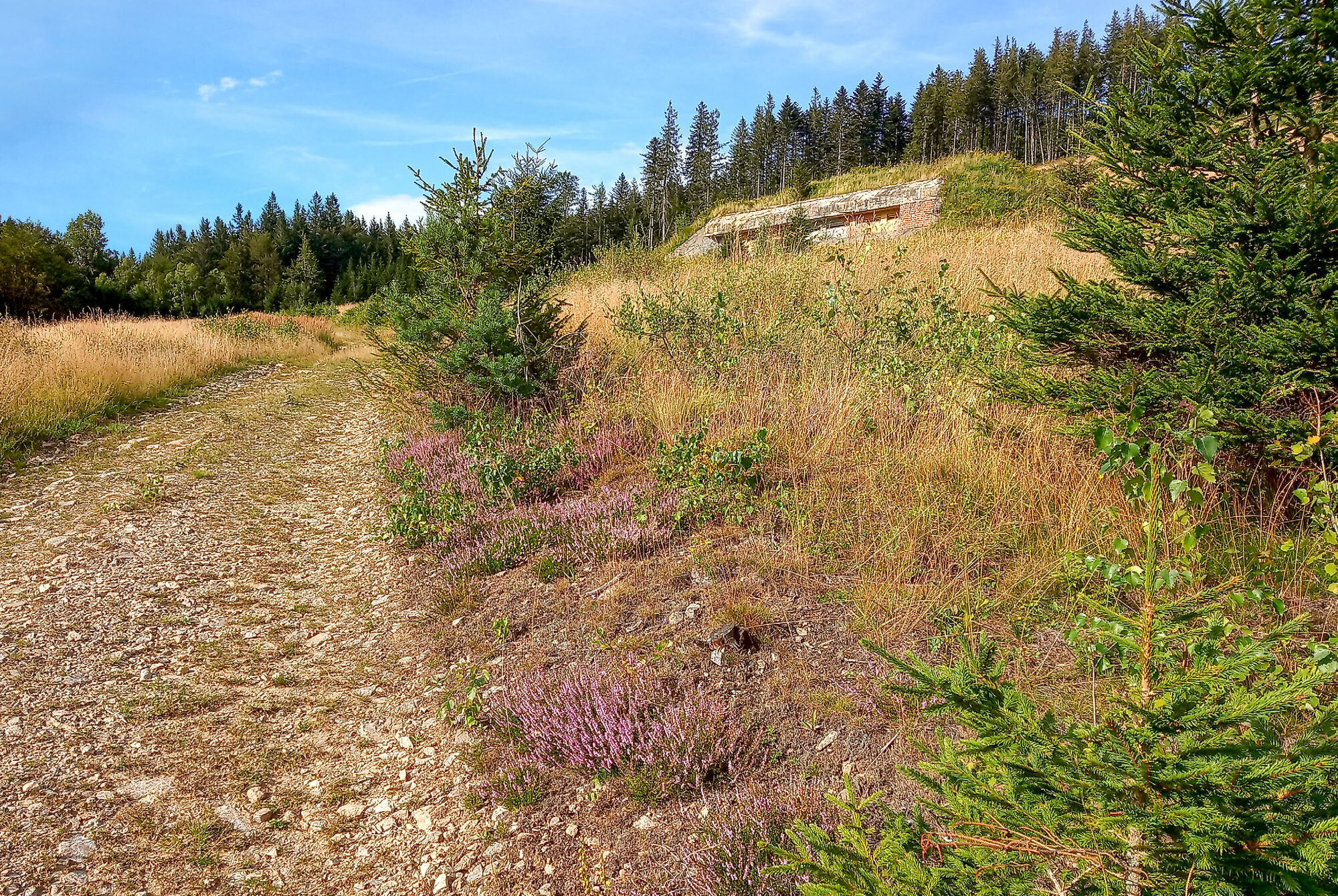
Cover photo: One of the surveyed sites within the monitoring was Blanice River National Nature Monument. © Alois Pavlíčko