
Nature Conservation 2022 — 25. 5. 2022 — Research, Surveys and Data Management — Print article in pdf
Shall We Go for Krkonoše/Giant Mts. Black Grouses with a Computer?
Yes, this is possible. Although computer modelling will not save the Black grouse, its outputs can significantly help in planning various practical measures in the field, regulating tourists at high-risk sites, and educating visitors. Habitat modelling, which uses the possibilities of geo-information technologies, remote sensing data, and advanced spatial analysis methods (e.g. Hirzel & le lay 2008, ElitH & leatHwick 2009), is applied significantly in the study of ecological requirements of (not only) animal species. These methods, technologies, and data allow extensive analyses of the relationships between the occurrence of species of interest and relevant environmental factors (e.g. Franklin 2010, Guisan et al. 2017). A common approach is to model the current or potential occurrence of species (e.g. tHuiller et al. 2004, Hirzel et al. 2006, Basille et al. 2008); the aim is to determine the landscape potential for their perma- nent or temporary occurrence and to evaluate the significance of individual environmental factors for their spatial expansion. Thus, habitat modelling is currently one of the most widely used approaches in conservation biology (e.g. Huck et al. 2010, Basille et al. 2013, Guisan et al. 2013).
Some necessary information to begin
The Krkonoše/Giant Mts. National Park (KRNAP, East Bohemia) is a vulnerable protected area with an extreme number of visitors (3.8 million people, or 11.9 million visiting days, in 2018) and a significant concentration of anthropogenic activities of all types, which penetrate even into areas with a predominance of natural and semi-natural habitats. The current development of local landscape use and, in particular, the intensity of recreational pressure on the area cause a high degree of fragmentation by anthropogenic elements (Fig. 2); these create significant barriers in terms of permeability and usability of the landscape for wildlife.

Figure 2 Degree of fragmentation of the Krkonoše/Giant Mts. National Park and its buffer zone (the redder the colour, the higher the fragmentation of the area). Source: Zýka & Romportl 2018
The Black grouse (Tetrao tetrix) is a species directly threatened by intensive human use of the landscape and its fragmentation. Suitable habitats for black grouses have still been there; however, their occupancy is significantly limited by disruptive effects of forestry or agriculture, building development, tourist infrastructure, and a dense road network.
The second largest population of the Black grouse in the Czech Republic survives in the Krkonoše/Giant Mountains and the jIzerské hory/ Jizera Mountains (Flousek 2019). However, with 80–100 lekking males in 2020, it is approaching the survival limit. In the Krkonoše/Giant Mts. alone, their number has fallen by more than half in the last 20 years. The main problem is not the lack of suitable habitats, but especially the area fragmentation and the negative impact of recreational activities (e.g., Patthey et al. 2008, Arlettaz et al. 2013, Formenti et al. 2015).
How did we proceed?
We used the MaxEnt method for habitat modelling (Phillips et al. 2006, Merow et al. 2013). The environmental variables included factors describing the basic abiotic gradients of the environment (altitude, vertical heterogeneity of the relief), habitat characteristics (derived from the Consolidated Layer of Ecosystems of the Nature Conservation Agency of the Czech Republic and the CzechGlobe – Global Change Research Institute of the Czech Academy of Sciences – see Hönigová & Chobot 2014), and anthropogenic disturbance factors expressed by distance from built-up areas, ski resorts (cable cars, lifts, ski slopes), and the road network. In addition, all roads were divided into three categories according to the intensity of traffic of pedestrians, cyclists, and motor vehicles – low, medium, and intensively used (for classification, data from automatic field counters and expert estimates of the KRNAP Administration field workers were used).
To model the connectivity of black grouse habitats, we chose the so-called least cost path (Beier & Noss 2008). Its principle presupposes at least a basic knowledge of the environment in which the organism moves. Simply put, the method seeks the easiest way to the objective, i.e. the connection of predefined core areas or stepping stones. The Circuitscape programme (McRae & Shah 2011) and Linkage Mapper tool (McRae & Kavanagh 2011) were used for the calculations.
Data from the area mapping of lekking black grouse throughout the KRNAP area during the spring of 1998–2017 served as the input basis for all evaluations (mapping according to the standard methodology, mostly at three-year intervals; a total of 1,480 records). The data gathered in this way show us the preference of males when choosing a lek, but they only partially indicate the nesting environment. Here we have been helped by published studies which show that black grouse nests are found and young are raised within a radius of 100–1500 m from the lek (e.g., Cayford et al. 1989, Zawadska et al. 2015, Scridel et al. 2017). With regard to the high fragmentation of the natural environment in the Krkonoše/Giant Mountains, we worked with the lower limit of this range, and in the preparation of the habitat model we evaluated habitats from a circle with a radius of 500 m from each lekking male.
Published data were again used to evaluate the sensitivity of black grouse to various types of disruption. Various sources indicate the flight initiation distance/alert distance of the Black grouse in a range from 30 to 1000 m (most often 50–500 m), depending on the season (the biggest mainly during lekking, the smallest during egg incubation, often different individual reactions during raising the young or wintering), on previous experience of disturbed birds, or on the type and factor of disruption (e.g. Currie & Elliott 1997, Zeitler 2000, Ruddock & Whitfield 2007, Tost et al. 2020). The impacts of the disruptive effect of the road network were therefore assessed in stages – low-used roads were given an escape distance of 50 m, medium-used roads 200 m, and for intensively-used roads, two alternatives were used – 200 or 500 m.
When assessing the connectivity of black grouse subpopulations, we counted on the average movements of adult males and females up to 1 km, or 5 km (e.g. Caizergues & Ellison 2002, Waren & Baines 2002, Marjakangas & Kiviniemi 2005), and on the stated audibility of black grouse lekking to a distance of 3 km (Hjorth 1970).
Habitat model
The habitat model shows the association of the Black grouse in the Krkonoše/Giant Mountains to the ridges of the mountains on the tree line and above it (subalpine and alpine grasslands with scattered dwarf mountain pine growths), open or non-stratified forest stands with clearings, to montane and subarctic peat-bogs and other natural and secondary treeless areas (Fig. 3). Based on the outputs of the habitat model, the core areas of black grouse occurrence were defined according to their occupancy during mapping in 2017 (Fig. 4).

Figure 3 Continuous habitat model of the Black grouse in the Krkonoše/Giant Mts. National Park (the greener the colour, the more suitable the habitat). Source: Romportl & Zýka 2018

Figure 4 Core areas of suitable black grouse habitats without the disturbing effect of road network and ski resorts (so-called grouse centres, which the KRNAP Administration created in the autumn of 2018 to increase the supply and interconnection of grouse habitats, are marked in red; in 2020, black grouse were lekking on seven of them, but their occurrence has already been proven in all of them). Source: Romportl & Zýka 2018
However, the model thus prepared evaluates the real impact of various human activities in a very limited way – movement of people on hiking and skiing trails and bike paths, operation of ski resorts and cable cars, and year-round movement of service vehicles on roads. In particular, the dense road network is an essential element that limits the occurrence of the Black grouse on potentially suitable areas. Therefore, other models were prepared according to the expected disturbing influence of low-medium-intensively used roads – in variants of 50-200-200 m for individual categories of intensity (realistic variant) and of 50-200-500 m (pessimistic variant) (Fig. 5 and 6).

Figure 5 Core areas of suitable black grouse habitats (occupied/unoccupied in 2017) taking into account the influence of road network and ski resorts (real variant: graded disturbing effect of low-medium-intensively used roads up to a distance of 50-200-200 m from them). Source: Romportl & Zýka 2018

Figure 6 Pessimistic variant of Figure 5 (disturbing effect of low-medium-intensively used roads up to a distance of 50-200-500 m from them). Source: Romportl & Zýka 2018
The availability of a suitable habitat is not limited only by its isolation or degree of fragmentation by barriers of various types, but also by the dispersive abilities of the Black grouse. Therefore, an analysis of the availability of suitable habitat fragments at distances of 1, 3, and 5 km was also performed. Further “fragmentation” of core are- as according to this criterion showed only a very limited supply of functional habitats (Fig. 7).

Figure 7 Core areas of suitable grouse habitats in various zones of their availability (real variant of influence of road network 50-200-200 m according to Fig. 5; availability zones 1-3-5 km). Source: Romportl & Zýka 2018
The analysis shows that black grouse (with average movements of up to 1 km) in the western, central, and eastern Krkonoše/Giant Mountains can already be isolated from each other. The situation could be more optimistic for females (with average movements of up to 5 km), where there has been still a realistic chance of their movements, at least along the Czech-Polish state border, within the entire mountain range. The audible range of black grouse lekking (3 km), especially important for female flights between leks, is not bad either; however, given the level of noise pollution in the area and the sensitivity of the Black grouse to noise, the actual audibility distance is likely to be significantly lower.
When quantifying the impact of different degrees of the above-mentioned disturbing influences on the size and character of the core areas distribution, we find a fundamental degradation of suitable habitats. Of their total area of over 6,600 hectares, two-thirds are negatively affected by the anthropogenic structures in their vicinity. In the case of the pessimistic variant, where the maximum range of disturbing effects of 500 m from intensively used roads is considered, the total area of a suitable environment is reduced to less than 1,100 hectares. The spatial structure of isolated patches of core areas is similarly significantly affected; their number is declining and the average patch size is also decreasing (Tab. 1). This increases the migration distances for the necessary movement of black grouses between suitable sites, and thus reduces the overall connectivity of habitats and subpopulations. In addition, the average patch size of 24 hectares has already been close to the minimum size of a continuous suitable habitat needed for black grouse nesting, which is stated to be around 20 ha (e.g. Decout & Signer 2010, Patthey et al. 2012).
Table 1 Changes in the area and spatial structure of the core areas of Krkonoše/Giant Mts. Black grouse suitable habitat at different intensities of the influence of anthropogenic activities and elements. Source: Romportl & Zýka 2018
|
The scope of the core area |
Total area |
Number of patches |
Average size of a patch |
|
Overall supply of suitable habitats |
6,616 |
133 |
49.7 |
|
Realistic supply |
2,214 |
72 |
30.7 |
|
Pessimistic supply |
1,089 |
46 |
23.6 |
Interconnection of core areas
The steps described above subsequently made it possible to model the connectivity of black grouse habitats – where optimal black grouse routes can lead so that they can move at least between adjacent patches of the core areas.
The connectivity model was developed in two variants, which reflect the current state and the potential for possible interconnection of suitable habitat sites. The model of the current state of connectivity (Fig. 8) represents a possible interconnection of patches that were occupied by black grouses during mapping in 2017. It captures the current state of the population, fragmented into several larger or smaller subpopulations, which are in many cases more than 3 km apart. The proposed movement corridors describe the most probable lines of interconnection of core areas; however, without a detailed field investigation it is not possible to determine their real permeability for black grouse.

Figure 8 Model of connectivity of suitable black grouse habitat core areas – current state (as of 2017). Source: Romportl 2018
The potential connectivity model (Fig. 9) is based on all core areas of a suitable black grouse habitat (see Fig. 4). Its output shows a more positive picture of the degree of potentially suitable habitat interconnection, where a significant part of movement corridors does not exceed 1 km in length and only a few are longer than 3 km. Again, it is necessary to take into account the real permeability of the corridors, which can be fundamentally affected by numerous disruptive activities in the area.

Figure 9 Model of connectivity of suitable black grouse habitat core areas – potential state. Source: Romportl 2018
In any case, both models suggest that the Black grouse is a species very sensitive to a decrease in connectivity in the area (and an increase in its degree of fragmentation), and therefore is a suitable umbrella species to protect the interconnectedness of natural elements in areas of its occurrence (cf. e.g. Kurki et al. 2000, Geary et al. 2015).
Conclusion
The Krkonoše/Giant Mts. National Park is not the only place in our country where a similar approach is used to protect the Black grouse. Habitat models for all grouse species are processed for Šumava/Bohemian Forest Mts. National Park; according to the Krkonoše/Giant Mts. experience, data from Jizerské hory/Jizera Mountains Protected Landscape Area are evaluated as well. As a result, we should have the entire territory of the Krkonoše/Giant Mts. Jizerské hory/Jizera Mts. black grouse population covered, including the Polish part of both mountain ranges.
The resulting recommendation of Krkonoše/ Giant Mts. modelling is clear and just trivial for a well-functional national park: To maintain a viable black grouse population in the Krkonoše/Giant and the Jizerské hory/Jizera Mountains, it is sufficient to consistently protect the interconnection of areas with habitats suitable for this species and not allow further fragmentation of the area by disruptive structures and activities. However, it is necessary to realize that the mere movement of people off the marked paths into the places where the Black grouse has still been living is a disruptive activity that devalues suitable habitats.
(Models of fragmentation, habitats, and connectivity for the KRNAP territory were pre- pared within the project MaGICLandscapes – Managing Green Infrastructure in Central European Landscapes, Reg. No. CE 897.) ■
- - -
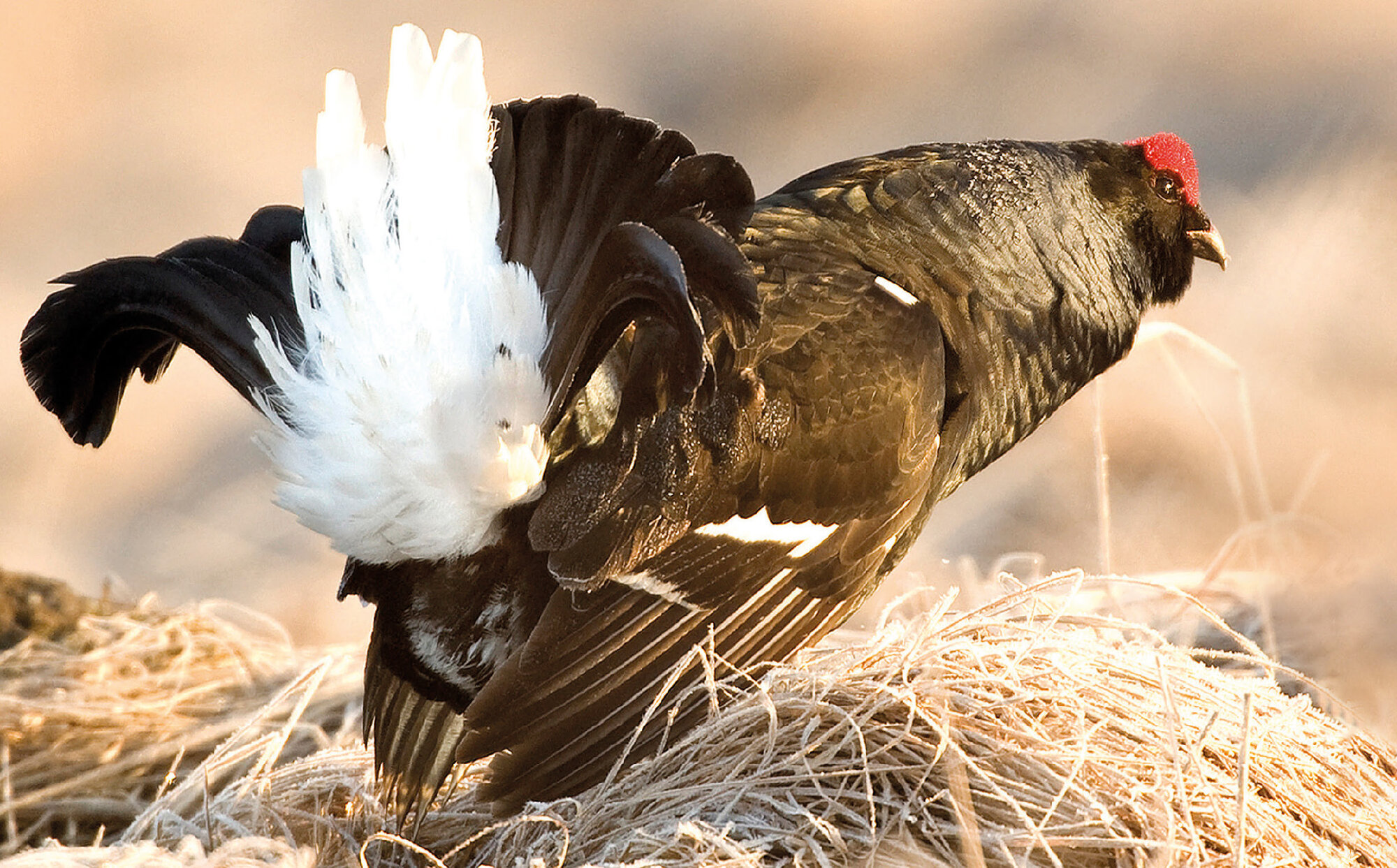
Intro Photo: Black grouse (Tetrao tetrix). © Zdeněk Patzelt
- - -
Seznam literatury
Arlettaz R., Patthey P. & Braunisch V. 2013: Impacts of outdoor winter recreation on alpine wildlife and mitigation approaches: a case study of the black grouse. In: Rixen C. & Rolando A. (eds), The impacts of skiing and related winter recreational activities on mountain environments. Bentham Science Publishers, Bussum: 137–154.
Basille M., Calenge C., Marboutin É., Andersen R. & Gaillard J.-M. 2008: Assessing habitat selection using multivariate statistics: some refinements of the ecological-niche factor analysis. Ecological Modelling 211: 233–240.
Basille M., Van Moorter B., Herfindal I., Martin J., Linnell J. D. C., Odden J., Andersen R. & Gaillard J.-M. 2013: Selecting habitat to survive: the impact of road density on survival in a large carnivore. PloS One 8: e65493.
Beier P. & Noss R. F. 2008: Do habitat corridors provide connectivity? Conservation Biology 12: 1241–1252.
Caizergues A. & Ellison L. N. 2002: Natal dispersal and its consequences in black grouse Tetrao tetrix. Ibis 144: 478–487.
Cayford J. T., Tyler G. & Macintosh-Williams L. 1989: The ecology and management of black grouse in conifer forests in Wales. RSPB, Sandy, UK.
Currie F. & Elliott G. 1997: Forests and birds: a guide to managing forests for rare birds. Forestry Authority, Cambridge and RSPB, Sandy, UK.
Decout S. & Signer J. 2010: Habitat distribution and connectivity for the black grouse (Tetrao tetrix) in the Alps. Workpackage 5: Corridors and Barriers, Cemagref + UBA, Umweltbundamt Wien: 21 str.
Elith J. & Leathwick J. R. 2009: Species distribution models: ecological explanation and prediction across space and time. Annual Review of Ecology, Evolution and Systematics 40: 677–697; https://doi.org/10.1146/annurev.ecolsys.110308.120159.
Flousek J. 2019: Přežijí krkonošští tetřívci rok 2040? Ochrana přírody 74, 2: 6–9.
Formenti N., Vigano R., Bionda R., Ferrari N., Trogu T., Lanfranchi P. & Palme R. 2015: Increased hormonal stress reactions induced in an alpine black grouse (Tetrao tetrix) population by winter sports. Journal of Ornithology 156: 317–321.
Franklin J. 2010: Mapping species distributions. Spatial inference and prediction. Cambridge University Press, New York.
Geary M., Fielding A. H. & Marsden S. J. 2015: Both habitat change and local lek structure influence patterns of spatial loss and recovery in a black grouse population. Population Ecology 57: 421–431.
Guisan A., Tingley R., Baumgartner J. B., Naujokaitis-Lewis I., Sutcliffe P. R. … & Buckley Y. M. 2013: Predicting species distributions for conservation decisions. Ecology Letters 16: 1424–1435; https://doi.org/10.1111/ele.12189.
Guisan A., Thuiller W. & Zimmermann N. E. 2017: Habitat suitability and distribution models with applications in R. Cambridge University Press, New York; https://doi.org/10.1017/9781139028271.
Hirzel A. H. & Le Lay G. 2008: Habitat suitability modelling and niche theory. Journal of Applied Ecology 45: 1372–1381.
Hirzel A. H., Le Lay G., Helfer V., Randin C. & Guisan A. 2006: Evaluating the ability of habitat suitability models to predict species presences. Ecological Modelling 199: 142–152.
Hjorth I. 1970: Reproductive behaviour in Tetraonidae with special reference to males. Viltrevy 7: 183–596.
Hönigová I. & Chobot K. 2014: Jemné předivo české krajiny v GIS: konsolidovaná vrstva ekosystémů. Ochrana přírody 69, 4: 27–30.
Huck M., Jędrzejewski W., Borowik T., Miłosz-Cielma M., Schmidt K., Jędrzejewska B., Nowak S. & Mysłajek R. W. 2010: Habitat suitability, corridors and dispersal barriers for large carnivores in Poland. Acta Theriologica 55: 177–192.
Kurki S., Nikula A., Helle P. & Lindén H. 2000: Landscape fragmentation and forest composition effects on grouse breeding success in boreal forests. Ecology 81: 1985–1997.
Marjakangas A. & Kiviniemi S. 2005: Dispersal and migration of female black grouse Tetrao tetrix in eastern central Finland. Ornis Fennica 82: 107–116.
McRae B. H. & Kavanagh D. M. 2011: Linkage mapper connectivity analysis software. The Nature Conservancy, Seattle WA; http://www.circuitscape.org/linkagemapper.
McRae B. H. & Shah V. 2011: Circuitscape user guide. The Nature Conservancy, Seattle WA; http://www.circuitscape.org/linkagemapper.
Merow C., Smith M. J. & Silander J. A. 2013: A practical guide to MaxEnt for modeling species’ distributions: what it does and why inputs and settings matter. Ecography 36: 1058–1069; https://doi.org/10.1111/j.1600-0587.2013.07872.x.
Patthey P., Wirthner S., Signorell N. & Arlettaz R. 2008: Impact of outdoor winter sports on the abundance of a key indicator species of alpine ecosytems. Journal of Applied Ecology 45: 1704–1711.
Patthey P., Signorell N., Rotelli L. & Arlettaz R. 2012: Vegetation structural and compositional heterogeneity as a key feature in Alpine black grouse microhabitat selection: conservation management implications. European Journal of Wildlife Research 58: 59–70.
Phillips S. J., Anderson R. P., Schapire R. E. 2006: Maximum entropy modeling of species geographic distributions. Ecological Modelling [online] 190: 231–259 [cit. 2015-04-17]; doi: 10.1016/j.ecolmodel.2005.03.026.
Romportl D. 2018: Analýza konektivity habitatů vybraných druhů živočichů. Zpráva k projektu MaGICLandscapes (dep. Správa KRNAP Vrchlabí): 9 str.
Romportl D. & Zýka V. 2018: Analýza habitatových preferencí vybraných druhů živočichů. Zpráva k projektu MaGICLandscapes (dep. Správa KRNAP Vrchlabí): 24 str.
Ruddock M. & Whitfield D. P. 2007: A review of disturbance distances in selected bird species. Report from Natural Research (Projects) Ltd to Scottish Natural Heritage: 181 str.
Scridel D., Groom J. D. & Douglas D. J. T. 2017: Native woodland creation is associated with increase in a black grouse Lyrurus tetrix population. Bird Study 64: 70–83.
Thuiller W., Arau M. B. & Hirzel A. H. 2004: Presence-absence versus presence-only modelling methods for predicting bird habitat suitability. Ecography 27: 437–448.
Tost D., Strauß E., Jung K. & Siebert U. 2020: Impact of tourism on habitat use of black grouse (Tetrao tetrix) in an isolated population in northern Germany. PLoS ONE 15: e0238660 (https://doi.org/10.1371/journal.pone.0238660).
Waren P. K. & Baines D. 2002: Dispersal, survival and causes of mortality in black grouse Tetrao tetrix in northern England. Wildlife Biology 8: 91–97.
Zawadska D., Zawadski J., Keller M., Palucki A. & Ciach M. 2015: Cietrzew Lyrurus tetrix. In: Chylarecki P., Sikora A., Cenian Z. & Chodkiewicz T. (eds), Monitoring ptaków legowych. Poradnik metodyczny. Wyd. 2. GIOŚ Warszawa: 154–161.
Zeitler A. 2000: Human disturbance, behaviour and spatial distribution of black grouse in skiing areas in the Bavarian Alps. Cahiers d’Ethologie 20: 381–402.
Zýka V. & Romportl D. 2018: Analýza fragmentace území Krkonošského národního parku antropogenními prvky. Zpráva k projektu MaGICLandscapes (dep. Správa KRNAP Vrchlabí): 17 str.