
Nature Conservation 2021 — 10. 6. 2021 — On Nature in the Czech Republic — Print article in pdf
Is the hydrological balance in forest catchment areas influenced more by climatic or vegetation driv
Between 2014 and 2019, Central Europe experienced unprecedented drought and heat. However, what was an unpleasant episode for most people and for ecosystems made it possible to answer some questions related to the hydrological regime in the Czech Republic´s landscape and, together with climate models, to outline the expected future.
Climate change
The Central Europe climate is characterized by a long-term increase in temperatures (Fig. 1) and a large variability in precipitation totals (Fig. 2), in which, however, no statistically significant trend can be found. Temperatures from Prague´s Clementinum observatory (Czech Hydrometeorological Institute data) from 1844–2019 show a rise in the second half of the 20th century (Fig. 1). The observed increase in temperature is about 1.5–2.0 °C from the early 1960s to the present. Precipitation (Fig. 2) does not change much but it does show great variability. If we look at the five-year precipitation averages, we find that a very dry "five-year period" was recorded in the 1860s, even drier than 2014–2018. The then catastrophic drought, when springs dried up and the harvest failed, is also mentioned in chronicles from that period.

If precipitation does not change for a long time and the temperature rises, the landscape dries up. The best theoretical concept of the intensity of the drying can be given by the calculation of potential (baseline/benchmark) evapotranspiration – this indicates how much water would evaporate from the landscape with standard vegetation as physical evaporation of water (evaporation) and transpiration (respiration) of plants. Furthermore, the quantity is potential – it is calculated for ideal conditions, where the plants always have enough water available for maximum transpiration. Potential evapotranspiration is then only a function of temperature and air humidity, the total precipitation does not matter. Potential evapotranspiration (in this case, calculated according to Ivanov) has significantly increased at Prague´s Clementinum observatory since 1844, when the measured air humidity is available (Fig. 2). While in the 19th century this was about 700 mm, in the 20th century it increased to 800-900 mm. However, it has grown dramatically in the last three decades – now about 1200 mm. While precipitation did not change, temperature-accelerated potential evapotranspiration increased by about 50% as the temperature increased.

Hydrological balance in forest catchment areas
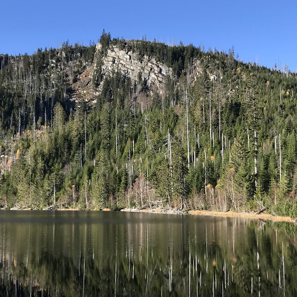
While long-term data from the Clementinum observatory mainly show climate change, the ecosystem change of the water cycle in the last three decades is shown on the water balance in small forest catchment areas. The Czech Geological Survey, in cooperation with the Institute of Global Change Research of the Czech Academy of Sciences (CAS) and other institutions (especially the Czech Hydrometeorological Institute, Forestry and Game Management Research Institute, Institute of Hydrodynamics of the CAS, Institute of Geology of the G CAS, and the Czech Technical University) operates and monitors a globally unique network of small river catchment areas (GEOMON) in mountain and foothill areas in the Czech Republic (Fig. 3). As it is now, the network has been in operation since 1994 (Oulehle et al. 2017). The river catchment areas are small (25-300 ha), concentrated in sensitive spring areas with homogeneous geological subsoil, and are forested, without agriculture or built-up areas. Thus, they allow the study of a relatively natural hydrological cycle.
The network consists mainly of commercial forest stands with a predominance of the Norway spruce (Picea abies) from about 450 m above sea level (a.s.l.) to mountainous locations with an average altitude of 760 m a.s.l. The network does not include forests with access to shallow groundwater resources (floodplain forests).
Precipitation total and the amount of rainfall on forest soil

Evaporation from the ground into the atmosphere is called evapotranspiration (ET) and, in a hydrogeologically well-defined river catchment, we can relate evapotranspiration to balance evaporation, which is given as the difference between precipitation and runoff (Ward and Robinson, Fendeková et al. 2018, Krám 2019). Average precipitation in the studied forest catchment areas ranges from 600 to 1800 mm per year, while total precipitation increases non-linearly with the altitude and increases on average by about 140 mm per year per 100 m in height. A part of the total evaporation in forests outside the direct evaporation from the soil is interception – capture and then evaporation of precipitation from the surface of trees (Klimo 1989, 1990, Ward and Robinson 1990, Černý et al. 2014). Only in the highest altitudes can capture of precipitation by trees (trapped fog and frost) be higher than interception losses, in which case more water falls onto the surface of the forest soil than in places without trees (Kopáček et al. 2020). In the vast majority of forests in the Czech Republic, however, the amount of precipitation is reduced by interception directly in the treetops. Long-term data show (Fig. 4) that interception in spruce forests in the Czech Republic is about 240 mm per year and decreases only very slowly with increasing altitude. Simultaneously, it is evident that the reduction of precipitation by interception is relatively most significant at lower altitudes; in our case, in forests around 500 m a.s.l., precipitation is reduced by 250 mm per year (i.e., by 40%).

A limited number of measurements of throughfall precipitation in beech stands (four river catchment areas) suggests that interception losses are lower in beech forest. The difference in interception between coniferous and deciduous broad-leaved stands is mainly due to reduced interception by the former in winter. In connection with the influence of stand structure on the amount of precipitation falling on the forest soil, it is necessary to mention precipitation captured by vegetation and flowing to the soil surface along the trunk (stemflow). This phenomenon is negligible in spruce forests, but in beech stands it can be an important source of water for forest soils (especially due to the architecture of the crown).

Transpiration and runoff of water from a catchment area
Physiological evaporation (i.e., transpiration) is the loss of water from a plant and is very closely related to photosynthesis and nutrient intake. Although direct transpiration losses by vegetation are not measured, its estimate will be close to the difference between the amount of water falling on the soil surface and measured surface runoff. In our conditions, when average forest cover of the studied river catchment areas reaches about 80%, average transpiration is 320 ± 60 mm per year. However, the value also includes direct evaporation from the soil, so actual transpiration will be slightly lower. Derived transpiration in forest catchment areas correlates with average annual temperature (Fig. 5). This relationship also shows that for each degree of average annual temperature the requirements for transpiration increase by about 40 mm. Evapotranspiration, including physical and physiological evaporation, is an average of 510 ± 90 mm per year for forest catchment areas in the Czech Republic (i.e., 60% of average annual precipitation).
In connection with climate change, the most striking phenomenon is the continuous increase in average annual air temperature. At medium altitudes (about 450-800 m a.s.l.), the years 2014-2018 were more than 2 °C warmer than the long-term average in 1961-1990 (5.4 °C). The trend in the amount of precipitation for the individual years is not conclusive, mainly due to the high year-on-year variability in precipitation totals. Nevertheless, average precipitation in 2014-2019 was on average 14% lower compared to 25 years ago, when river catchment area monitoring began. Lower annual precipitation totals in combination with higher temperatures resulted in a significant decrease in flows, which in 2014-2019 was 42% lower than the average for the same length period 1994-1999 (Fig. 6).

The decrease in flows was due to a reduction in the input of precipitation into the river catchment area and higher demands on evapotranspiration. It increased by an average of 55 mm, with a temperature increase of 1.4 °C. This value agrees with relationship between transpiration and annual average air temperature derived from the temperature gradient of the studied river catchments. Simultaneously, this transpiration increase was recorded in catchment areas above 600 m a.s.l. In forests below 600 m a.s.l., transpiration even decreased in 2014-2018 compared to the long-term average because of withering of stands due to low availability of water in soil. In these areas, the situation was critical for small streams, where natural demands for evaporation were already close to or even exceeding annual precipitation totals. Simultaneously, the year-on-year decrease in precipitation and increase in temperature may increase evaporation to such an extent that the situation may result in periodic drying of forest streams (Fig. 7). This is often preceded by a drop in the groundwater level, as it is able to temporarily subsidize the basic minimum flow.

However, the studied forest catchment areas have a relatively small groundwater supply. According to research using the natural stable oxygen isotope 18O, the average water retention period in a river catchment area is in months and the mobile water supply in a river catchment area is in the low hundreds of mm (Buzek, unpublished data). Therefore, groundwater in the river catchment areas (mainly on crystalline rocks at medium and higher altitudes) is not able to further subsidize surface runoff for a long time – a rapid decrease in flows usually occurred in the year following a year with relatively lower precipitation compared to the long-term average.
Commercial forest decline and influence on the hydrological balance
Water evaporation from vegetation (transpiration) is the main way water evaporated from continents returns to the atmosphere (Jasechko et al. 2013). Simultaneously, the share of evapotranspiration in total precipitation is surprisingly stable globally, reaching about 60-70% of total precipitation, regardless of the ecosystem type. When an ecosystem is disturbed, either naturally or artificially (e.g., by logging), the water cycle is disrupted; however, acting feedback dampens extreme events, whether drought or floods. During the collapse of the mature tree layer (especially coniferous stands), in the vast majority of cases, interception decreases and the amount of water falling on the forest soil surface increases, while transpiration decreases. It is important to realize that transpiration is a basic property in all vegetation, so the decline in transpiration will be proportional to the ecosystem's ability to replace this failure with vegetation caused by succession in disturbed areas (Jančo et al. 2017). The undisturbed development of subsequent vegetation, whether grasses, shrubs, or pioneer tree species, thus becomes an important element in water balance, as it very effectively replaces the transpiration of the original forest (Oreňák et al. 2014).
The phenomenon can be documented in the Modravský potok/Modrava Brook catchment area in the Šumava/Bohemian Forest Mts. National Park (Hruška et al. 2015). In this catchment area (92.7 km2), where the hydrological balance has been monitored since the early 1950s (CHMI), there was a rather fundamental change in vegetation cover after the declaration of the National Park in 1992. In about one third of the catchment area, mature forest underwent European spruce bark beetle outbreak, and was left to develop spontaneously without removing the dead tree biomass. In another third, the forest was harvested within the fight against bark beetle and replanted, and the remaining third remained a living mature forest. Simultaneously, peat-bog restoration was carried out in part of the brook catchment area, consisting of the damming of drainage ditches. This mosaic of various management measures had no effect on the hydrological balance of the watercourse catchment area – no statistically significant changes in annual runoff or evapotranspiration were recorded (Fig. 8). The reason was that the immediately emerging vegetation relatively quickly increased interception of precipitation and transpiration, and thus dampened the decline in evaporation by the missing mature spruce stands. The peat-bog restoration (and thus an increase of water supplies in the catchment area) probably also had an effect.

Another example is the hydrological balance of several small river catchment areas (Uhlířská and Jizerka) in the Jizera Mountains, where the spruce forest died in the 1980s due to acid deposition and was harvested almost immediately. There, runoff increased by about 10% in the short term (2-3 years). After that, no change was apparent compared to the situation before harvesting due to air pollution. These river catchment areas, in contrast to the Šumava/Bohemian Forest Mts., were felled and biomass was removed in about 80% of the catchment area. There too, however, new vegetation (herbs) very quickly hydrologically replaced the transpiration and interception of dead commercial spruce.
In both cases, it was a change in the vegetation structure under relatively stable precipitation and temperature conditions. In contrast, results from the GEOMON catchment areas show a relatively stable catchment cover, but significant changes in precipitation and temperature. The comparison clearly demonstrates that the long-term hydrological stability of the Central European forest landscape was until recently very robust and the current influence of vegetation cover did not have much importance. The role of the "favourable" forest influence on runoff conditions has never been confirmed by data, and the requirement of continuous coverage of the area with a "green" forest is not absolutely necessary. Plant transpiration (which is the main source of water evaporation into the atmosphere, climate cooling, and contribution to a small water cycle), acts very similarly both in the forest and on other types of vegetation (meadows, pastures). The decisive factor is the amount of precipitation and the change in temperature, not the type of vegetation. However, it is obvious that the microclimate is much more favourable in a landscape where green vegetation is present throughout the growing season and, needless to say, that in built-up or poorly farmed areas there is a (permanent/seasonal) decrease in evaporation and thus the landscape loses its ability to cool naturally.
What to expect from climate change?
Climate models for Central Europe quite consistently predict an increase in average temperatures with precipitation keeping as it is, or even an increase in totals (e.g., Lamačová et al. 2018). However, the extremization of precipitation will be important in the future – especially higher frequencies of large precipitation (floods and exceeding saturation capacities of river catchment areas), but also an increase in the frequency of periods with very low precipitation, and thus also periods when there will be water shortages in river catchment areas. It was the period of 2014-2019 that probably offered us a hydrological excursion into the future. However, so far only a "dry" variant without extreme precipitation.
Specifically, for the already mentioned Modravský potok/Modrava Brook catchment area, climate models (a combination of many scenarios of climate change different levels) predict an increase in the number of days with extremely high precipitation (Tab. 1). Although in the thirty-year control period (1981–2010) there was a total of 63 days with precipitation higher than 49 mm (99% quantile; i.e., 1% of the highest precipitation totals), for 2021–2050 it will increase to 86 days and for 2071–2100 to 97 days (i.e., by about a third). The number of days without precipitation will not change much. Alongside an increase in the frequency of extreme precipitation, there will be an increase in the maximum daily flows, namely up to values of about 20-30% higher than those recorded so far (Tab. 1). Total precipitation totals will increase by about 10–15% for the whole Czech Republic (Štěpánek et al. 2019).
Thus, a combination of drought and short-term high rainfall and floods can be expected. And, in both cases, more extreme than we have been used to. Both the extremes will occur regardless of vegetation cover in a catchment area, which will probably not change very much.
Conclusion
The current collapse of commercial forests (especially spruce) is a consequence of the low ability of monoculture/plantation management to cope with rapidly changing environmental conditions, such as rising temperatures and increased variability in the total and distribution of precipitation. Forest production, obviously and purposefully set to the conditions experienced in recent centuries, has been reaching its limits, especially in areas where the demands for evaporation are close to the precipitation amount. These areas can be roughly defined in the range of altitudes 450–600 m a.s.l. Monoculture/plantation spruce management leads to a reduction in the input of precipitation into forest soil due to high interception losses (up to 40% of precipitation loss when the rain passes through a treetop) and to high transpiration demands of forests primarily grown to maximize biomass production there. Reducing precipitation input, often combined with higher temperature, then results in drought stress due to reduced soil moisture and groundwater levels, followed by reduced photosynthetic activity in trees. At such sites, it is essential to adapt forest management to conditions with an expected increase in temperatures (increase in transpiration requirements) and the possible periodic occurrence of years with below-average precipitation. Growing and managing structurally rich forests with a natural species composition should reduce interception losses and strengthen the use of available water in the entire soil profile. This is best achieved by growing mixed forests with variable root zone depth and varied crown architecture.
The landscape and water regime would greatly benefit from restoration of streams and their floodplains, as well as restoration or building of new wetlands. Drainage, with the aim to gain productive land for growing trees, has been carried out in forests since the end of the 18th century. The water was more of an obstacle in the forest. However, this situation is changing dramatically today, and rapid runoff of water from the landscape is not desirable. Capture the expected large rainfall on the spot, and not guide and direct it elsewhere. Dams are not known to protect against major floods, nor can they hold back water. Wetlands and restored valley floodplains will contribute to a better groundwater supply which can then subsidize runoff and soil profile for longer. The goal of current landscape protection should be to retain water in the places where it has fallen, because only there can it provide the landscape with water and keep it functional, even under the conditions of expected and projected climate change. We must consider water retention in the landscape context, and not as a medium that has primarily economic functions. Of course, we cannot do without drinking water; however, reducing the water cycle to supplying the population and industry with water would certainly be short-sighted and counterproductive.
Acknowledgements
The article was elaborated with the support of the AV21 programme "Water for Life" and the project "Balance of groundwater reserves in the crystalline rocks" implemented by the Czech Geological Survey.
A big thank you to all those involved, whether now or in the past, in the monitoring of GEOMON small forest catchment areas, without which the study of the hydrological regime of small catchment areas would not be possible. Namely, it goes to colleagues from the Institute of Geology of the Czech Academy of Sciences (Tomáš Navrátil), the Institute of Hydrodynamics of the Czech Academy of Sciences (Miroslav Tesař), the Forestry and Game Management Research Institute (Vladimír Černohous & Zdeněk Vícha), and the Czech Hydrometeorological Institute. We would also like to thank Daniela Fottová, an emeritus employee of the Czech Geological Survey, who founded the GEOMON network and coordinated it for two decades.