Nature Conservation 2025 — 31. 7. 2025 — Články bez rubriky — Print article in pdf
Summary of 2024 Issues
On Nature in the Czech Republic
Zajíček P.: The Most Recent Knowledge about Findings in the Kateřinská jeskyně/Catherine’s Cave
At present, in total 13 prehistoric carbon drawing traces are registered at various sites within the Old Kateřinská jeskyně/Catherine’s Cave (the Moravský kras/Moravian Karst, South Moravia). In 2016, detail research on rock walls had begun there. In 2019 a series of samples was taken and it was found that three of them are about 6,500 years old: they became the oldest cave charcoal drawing traces on the Czech Republic’ territory. In 2023, other drawings from the Ledová chodba/Ice Corridor were successfully dated back. One of them is located between previously dated prehistoric drawings. The other two are situated in a more remote part of the corridor where there have been hundreds of inscriptions, signatures and years of modern times since the late 18th century. All the drawings are 5,200 to 6,500 years old. According to the past findings, a massive and spacious portal of the Kateřinská jeskyně/Catherine’s Cave and at the same time also space in the near Suchý žleb/Dry Canyon were for a long time inhabited by prehistoric humans in the Late Neolithic Period as well as in younger periods. Inner space of the Kateřinská jeskyně/Catherine’s Cave behind a narrow corridor 60 meters long was definitely not permanently inhabited because there was no permanent fire. The most probable explanation why the inner part of the cave was repeatedly visited by humans is that the space was considered to be a shrine. Finding of the oldest prehistoric charcoal graffiti in the Czech Republic had opened other possibilities of a comprehensive research at the unique site carried out in 2021 and 2023. The most important findings are from sediments in the non-named corridor. Prehistory was represented by shards from ceramic containers 3,000 to 4,000 years old, i.e. from the Bronze Age. Discovering a secret money counterfeiting workshop from the Middle Ages, the very first in the whole Moravský kras/Moravian Karst, was the most surprising discovery there. Finding a prehistoric stone arrow from light Scandinavian chert and particularly of two slate fragments where a procession of figures is depicted is also unique. It resembles a procession of Hittite gods of the Underworld known from a rock relief in the Yazilikaya Shrine in Hattusa in Turkey. Age and origin of the former discovery has been still examined as well as the fact how the fragments arrived into the Moravský kras/Moravian Karst.
Tájek P.: Natural Values of the Slavkovský les/Slavkov Forest Mts. Protected Landscape Area (West Bohemia)
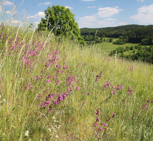
The Slavkovský les/Slavkov Forest Protected Landscape Area (PLA) was declared in 1974, being the 17th PLA in the former Czechoslovakia. Since its very beginning, it has been aiming at mineral springs and their infiltration areas. In addition to hundreds of mineral springs used by humans or freely rising at distant sites of the sparsely populated region, the Slavkovský les/Slavkov Forest Mts. also harbours a lot of very important natural phenomena – extensive forest peat-bogs, the largest serpentinite area in the Czech Republic, many well-preserved wet meadows or sunny dry slopes with rare orchid species. The PLA also includes the spa towns, namely Karlovy Vary/Carlsbad, Mariánské Lázně /Marienbad and Lázně Kynžvart. The romantic landscape of broad-leaved deciduous forests in the vicinity of Karlovy Vary/Carslbad and Mariánské Lázně /Marienbad, interwoven with trails for walks of spa guests, was also inscribed in the UNESCO World Heritage List in 2021. At the same time, in the Slavkovský les/Slavkov Forest Mts. there are many historic heritage monuments: among the most famous, the Loket Castle, Bečov nad Teplou Castle, Kynžvart Castle and a hunting lodge at the settlement of Kladská should be mentioned. They symbolize the harmonious landscape where historic heritage values meet natural ones and by combing both of them, unique landscape units are formed. More information can be found in Arnika/Volf’s Bane Journal having been published since 1975. It originally aimed at the Slavkovský les/Slavkov Forest Mts. region, but since 2004 it has also been dealing with interesting issues, fun facts on and new knowledge about the whole Karlovy Vary/Carlsbad Region provided by natural and historical sciences.
Vylita T.: The Slavkovský les/Slavkov Forest Mts. as the Spa Therapeutic Landscape
The Slavkovský les/Slavkov Forest Mts. is a part of the world-famous West Bohemian mineral spring area spatially related to the Oher rift structure and wretch or transverse deep fits. The area is from a point of view of hydrogeology absolutely extraordinary by mineral water outflows of various types, spring gas effluxes and peloid reservoir development. Contrary to other identically protected areas, the Slavkovský les/Slavkov Forest Mts. Protected Landscape Area (PLA) was established to preventively protect the natural supportive environment of the most important spas in the Czech Republic – Karlovy Vary/Carlsbad, Mariánské Lázně/Marienbad, Lázně Kyžvart as well as the former spas at Prameny/Springs, Podlesí, etc. In addition to natural therapeutic sources, namely spring waters or natural mineral water sources, there also are peloid reservoirs, declared and protected as natural therapeutic source (from the former village of Čistá to the town of Krásno) or protected from other reasons (Kladská Peat-bogs) and spring gas effluxes, of them carbon dioxide prevails. Within the PLA, specific climate conditions in spas of Lázně Kynžvart and Mariánské Lázně/Marienbad are also used for therapeutic purposes. Effect of the so-called spa therapeutic landscape located in the vicinity of natural therapeutic spas in the Slavkovský les/Slavkov Forest Mts. has been recently officially recognized in this respect.
Krása A.: The Aesculapian Snake in the Vltava River Basin
The Aesculapian snake (Zamenis longissimus), the biggest snake in the Czech Republic attracts everybody’s attention at first glance by just its size or climbing skills. For biologists and nature conservationists, history of its findings in the Czech Republic, namely in the Ohře/Eger River Basin, Dyje/Thaya River Basin and in the Bílé Karpaty/White Carpathians Mts. is interesting. Almost every year an individual is found outside the above areas. To identify a new population, repeated findings and survey in suitable habitats are crucial. Specific factors for the snake include a typical river phenomenon, intensive gardening with often mowed grass that produces a lot of composts, livestock breeding with stables and dunghills and various small buildings falling in ruins.
The above patterns were confirmed in the Vltava/Moldau River Basin south of Prague, in area delineated by the Vltava/Moldau River and the village of Krňany and of Třebsín (Central Bohemia). In 2016-2020, more than 100 reports on the occurrence of Aesculapian snakes of all age classes were gathered. Only 26 individuals were directly observed and 18 of them were captured. The findings are from both dumps, landfills, composts or small gardens and directly from buildings. In meadows and forests the snakes were almost missing. From some shaded skins and dead individuals found, samples were taken for further DNA analysis.
Fuglíková J.: Availability of Food and Sites for Sleeping and Providing Offspring with Food – These are Troubles for Czech Insect Pollinators!
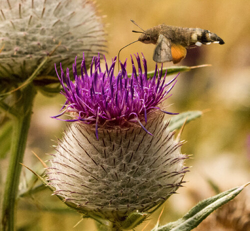
Insect pollinators have been rapidly declining in the Czech Republic as well as in other European Union’s Member States, some of them being on the verge of extinction. Their importance is not only in food production but pollination is an essential precondition to maintain healthy and diverse ecosystems. There has been no single driver of wild insect pollinators decline and loss. The drivers include land-use changes, intensive production, pesticide use, environmental and light pollution, invasive alien species, pathogens and climate change. Pollinators are a huge and diversified insect group, in the Czech Republic including mainly bumblebees (Bombus spp.), hoverflies (Syrphidae), house flies (Muscidae), beetles (Coleptera), butterflies and moths (Lepidoptera) or wild bees as well as the Western honey bee (Apis mellifera).
And possible consequences of the insect pollinator decline and loss? Almost 90 % of world’s wild flowering plants depend at least partially on animal pollination to reproduce, 50 % of them depend fully. Plants cannot learn to live in the world without pollinators, breaking a long-term co-evolution of plants and insects is irreversible and has principal impacts not only on both the groups of organisms. Pollinators offer an excellent possibility to be model organisms for explaining importance and necessity of wild living organism biological diversity. They also provide indisputable benefits when pollinating orchards, vegetable fields or gardens, wild pollinators enhance or directly provide food production, particularly crops of high nutritional value. The latter is the principal reason why we should protect and conserve the above insect group, too.
Zatloukal V., Mašková R. & Beranová J.: Using Non-Native Woody Plants for Climate Change Adaptation Measures
As a response to current climate change, the Government of the Czech Republic approved the comprehensive National Action Plan on Adaptation to Climate Change in 2017, requiring, inter alia, “to methodically unify use of geographically non-native woody plant species being non-invasive and not hybridising with native ones, reaching maximally 20% of growth composition: these are particularly the European larch (Larix decidua) and Douglas firs (Pseudotsuga spp.)”. Climate change is among the drivers of massive abatement of the Norway spruce (Picea abies), the most common and from a point of view of timber production the most important woody plant species in the Czech Republic resulting in a long-term decline in timber production and changes in range of products. High proportion of forest soils has been disturbed by acidification and nutrition degradation mainly due to large amount of nutrients through huge biomass extraction, particularly if also brushwood and biomass, which is not a part underground timber mass and has not the diameter larger than 7 mm including the bark, are removed. Moreover, the timber production, which is a pillar of forestry depends on long-term sustainability of forest ecosystem functioning. Therefore, excessive direction towards the production should not threat the functioning. Enhancing water regime in forest soils is supported particularly by preventing new drainages and remediation of old ones despite partial losses in production, restoration of canalized watercourses and by remediation of unsuitable and unused roads, grooves and tracks. Setting the limits for use of non-native woody plant species was based on analysing forest health and threats of forests possessed by climate change, assessing possibilities of native woody plant use in adaptation of forest to climate change, selection of suitable non-native woody plant species and setting limits for their use. If climate change scenarios will accomplish themselves, large changes in woody plant species composition with signification increase in oak (Quercus spp.) proportion should be expected in the Czech Republic in 20 – 40 years.
Nature & Landscape Management
Hošek M., Bartaloš T., Kadlubiec R., Kešner M., Pavka P., Pavková K. & Trojáček P.: Delineation and Conservation of the Floodplain Significant Landscape Element
Among Significant Landscape Elements (SLEs), sometimes called also Significant Landscape Features (SLFs), floodplains display the greatest difficulty both in delineation and conservation. In addition to long-term needs, the importance of floodplains has been newly highlighted in the currently debated European Union’s Nature Conservation Law. One of its key targets is in fact principal restoration of watercourses which only hardly can be implemented without whole areas of their floodplains. In 2020 – 2023, the authors tried to solve the problem of missing methodically unified approach by project entitled Practical tools for floodplain significant landscape feature protection and planning and funded by the Technology Agency of the Czech Republic. The process was divided into two steps. Framework delineation of floodplains along significant watercourses in the Czech Republic is based on automated source data processing and is characterized by lower precision and accuracy (scale 1 : 25,000). The above outputs of the project dealt with more than 16,000 kilometres of significant watercourses, totally covering approx. 6,550 km2. Detailed floodplain delineation uses mostly manual delineation in maximally feasible precision and accuracy, i.e. on minimal scale 1 : 10,000, on significant as well as small watercourses in the extent of municipality with extended powers (MEP) administrative district, applying also the framework delineation. The detailed floodplain delineation procedure was tested on territories of three MEPs. In addition to the delineation procedure, some other products were generated, namely Floodplain categorization, Catalogue of floodplain functions and Manual for using the data of delineated and categorised floodplains in planning documentation. The methodology for floodplain delineation has an ambition to become the principal expert/technical background for delineating floodplains of watercourses in the Czech Republic, potentially unifying floodplain delineation and categorisation by State/Public Administration authorities, including land-use/territorial planning.
Lysák F., Chytrá H. & Kotasová Adámková M.: Slovácké lúky/Moravian Slovakia Meadows: A Way to Restoration
Slovácké lúky/Moravian Slovakia Meadows situated in the Dyje/Thaya River floodplain on the eastern edge of the municipality of Lednice (South Morava) and closely following on from famous Lednice Castle Park harbour extensive and comprehensive floodplain meadows covering approx. 200 hectares. The site preserves the unique biodiversity-rich environment providing a huge range of wild plant and animal species with suitable habitats for their occurrence. Despite their size and diversity, the meadows have partially lost their natural values. Some parts are included in the Niva Dyje/Thaya River Floodplain Site of European Importance (pursuant to Act No. 114/1992 Gazette on Nature Conservation and Landscape Protection, as amended later, the term for Site of Community Importance, SCI, later Special Areas of Conservation, SAC, under the European Union’s Habitats Directive) and the whole area would become a part of the proposed Soutok/Morava and Dyje/Thaya Rivers Confluence Protected Landscape Area. In 2023, within the Jedna příroda/The One Nature project a framework restoration study was conducted aiming at assessing the current state and restoration capacity of the area. The study examines natural conditions, history, drivers of degradation, current state including negative factors as well as possibility to restore the site, taking into account local specificities and restrictions caused by water management and other interests at the site. The study’s main topics include water regime and vegetation of grassland and wetland habitats in the above area.
Tájek P., Kožíšková H., Tájková P. & Jaška P: Nature Protection, Conservation and Management in the Slavkovský les/Slavkov Mts.
As similarly to other Protected Landscape Areas (PLAs) in the Czech Republic, nature conservationists also in the Slavkovský les/Slavkov Forest Mts. (West Bohemia) deal with grassland management, enhancing forest tree composition or creating pools to support threatened water animal populations. First targeted interventions had begun about in 1990: they included self-seeding woody species removal at the most valuable sites outside forests. In the beginning the measures had been carried out by volunteers, in the 1990s possibility to fund them from the Ministry of the Environment of the Czech Republic appeared in the 1990s. Therefore, their number has been step by step increasing. The Slavkovský les/Slavkov Forest Mts. PLA was one of the first areas in the Czech Republic where peat-bogs and mires restoration started. First wood small dikes appeared on drainage canals as early as in the middle 1990s. Although a lot of partial restoration measures have been implemented, the total landscape wate retention capacity has unfortunately not been in good conditions. Many legislation and ownership restriction do not allow to change it. Nevertheless, the landscape water retention capacity has been partially increasing at least by creating new small water bodies. In 2013 – 2023, thanks to subventions/subsidies more than 174 pools covering totally 2.98 hectares and reaching the total volume of 20,800 m3 were created or restored there: the average size of the pools is 171 m2.
Hubený P.: Natural and Artificial Forest Restoration Effectivity
For assessing natural and artificial forest restoration effectivity four clearings after logging (Laka, Lenora, Říjiště and Perník) and a site after wind and European spruce bark beetle (Ips typograhus) disturbances (Poledník) in the Šumava/Bohemian Forest Mts. Two sites, namely Poledník and Řájiště, were not artificially reforested. At Říjiště site, two 20 x 20 meters game-proof fences were established where European silver firs (Abies alba) were planted, within a clearing artificial restoration were not applied. At the other sites artificial planting was carried out aiming at improving species composition in the future growths. From these plots, restoration density and its species composition were derived. The final density was compared with records on numbers of tree species used in artificial restoration. One of the main goals of the study was to find in which extent artificial planting can influence future forest stands. Assessing the number of individuals contributing to rejuvenation on the clearings and artificial planting effectivity aiming at changing species composition in favour of other trees than the Norway spruce (Picea abies) suggest that the whole process has been dominated by natural regeneration and by coming-back prevalence of Norway spruce forest where undoubtedly also other woody plant species shall survive: the latter shall not definitely prevail in the future forest generation. On clearings forests similar to those being there before logging shall grow, in many aspects they shall be more structured, possibly with more gaps; nevertheless, they will be similar to the previous ones. Surprisingly enough, they will be also similar to those growing there in the 19th century, i.e. to descendants of primary forests.
Vondřejc T.E.: Alpine Longhorn Beetle Management in the Vlára River Pass Special Area of Conservation
The Alpine longhorn beetle, also known as the Rosalia longicorn (Rosalia alpina) is among the most beautiful beetles occurring in the Czech Republic. Its bright blue coloration with black spots on elytra makes it an unmistakable species. Its life cycle lasts three years. Alpine longhorn beetle’s main food woody plant unambiguously is the European beech (Fagus sylvatica); moreover, it can also inhabit other deciduous broad-leaved trees, e.g. the Wytch elm (Ulmus glabra) or the Sycamore (Acer pseudoplatanus). The beetle requires sufficient amount of dead wood because females oviposit the fertilized eggs into it: they use both fresh breaks, standing remnants of trees or fallen trunks and dying wood on trees having been still living.
In Bohemia, the last population lives in the Ralská pahorkatina/Ralsko Uplands, on Malý Bezděz and Velký Bezděz hills. In Moravia it occurs in floodplain forests along lower reaches of the Morava/Moravia and Dyje/Thaya rivers. The Bílé Karpaty/White Carpathians Mt. Protected Landscape Area (PLA, Southern Moravia) is inhabited by beetle’s Carpathian population that can be found particularly in the Vlára River Pass. The Nature Conservation Agency of the Czech Republic, namely its Bílé Karpaty/White Carpathians Mts. PLA Regional Branch, has been for several years implementing a lot of measures aiming at targeted support to and conservation of the Alpine longhorn beetle. Regular monitoring of Specially Protected Species and of their habitats is an important part of their management. In the Vlára River Pass area, targeted mapping including a concurrent assessment of management measure impacts has been for several years carried out. From this point of view, particularly an inventory aiming at saproxylic and mycophagous beetles performed in 2018 was principal: 222 species were determined in the course of it.
Knižátková E., Šikola M., Machoňová D., Volf V. & Jetenská E.: Results of the Finished Project Aiming at Providing Specially Protected Areas with Planning Documentation
The project “Providing Planning Documentation for Sites of National Importance in the Czech Republic” that includes Outlines of Recommended Measures II (ORM II) contributed to further systematic development of the EU Natura 2000 network management in the Czech Republic. Not only there are high-quality planning documents available both for Sites of European Importance (SEI, pursuant to Act No. 114/1992 Gazette on Nature Conservation and Landscape Protection, as amended later, the term for Site of Community Importance, SCI, later Special Areas of Conservation, SAC, under the European Union’s Habitats Directive) and Bird Areas (pursuant to the above act, the term for Special Protection Area, SPA under the EU Birds Directive) as well as Management Plans for Small-size Specially Protected Areas overlapping with Natura 2000 sites fully taking into account requirement of species and natural habitats of the EU importance, but it also was for the first time more holistically examined in the sample of more than 200 sites whether the measures are successfully implemented just in the field. The results have been directly applied in immediate management of the individual sites under study. Moreover, they have also pointed out some more systemic issues requiring more comprehensive solutions. For example, more attention should be paid to sites under the so called basic conservation in the near future so that the status of the subjects of conservation will not be threatened there in the long term. The project should not be considered to be the end of such activities. The activities of the ORM II project have been directly followed and more elaborated by the One Nature IP LIFE project.
Bedan R., Svobodová O. & Krása A.: The Peregrine (Falco peregrinus) in the Moravský Kras/Moravian Karst
From a point of view of nature’s values and species richness, the Moravský kras/Moravian Karst (South Moravia) is of great importance. In addition to many other wild animal jewels the Peregrine (Falco peregrinus) has been again occurring there. In the past often 3 to 4 pairs had nested there. Moreover, they have disappeared from 1957, particularly due to applying DDT pesticide. In 2016, the positive change appeared. The first pair was found in the Vývěry Punkvy/Punkva River Springs National Nature Reserve (NNR): breeding was successful, because peregrines reared three young. The Peregrine’s comeback brought about necessity to deal with new issues related to attendance of the Moravský kras/Moravian Karst Protected Landscape Area (PLA) by tourists and risk of undesirable disturbance. During nesting of the first pair it was not necessary to implement any measures in the field and the breeding was kept secret because due to distantness of the nest. From the very beginning, Nature Guards were significantly involved in the above activities. They delineated the area with restricted entrance and checked and reinforced the restrictions applied. During the last nine years when peregrines have been again present in the Moravský kras/Moravian Karst, there were 19 breeding attempts. Of them 15 were successful: totally, 40 young fledged. The year 2018 was the most successful, because from both nests four young fledged. The first failed nesting was found only a year later, i.e. in 2019. Three nestlings from a nest in the Vývěry Punkvy/Punkva River Springs NNR were shortly before fledging preyed by the Eagle owl (Bubo bubo) breeding approx. 700 meters from the Peregrine’s nest. Thus, peregrines resettled the Moravský kras/Moravian Karst spontaneously and successfully. The authors believe that despite some difficulties peregrines will nest successfully there also in the future.
Soukupová F. R., Sedláček L. & Vacek D.: Supporting the Green Infrastructure in Settlements
The Green Infrastructure is a crucial step towards more sustainable towns and cities resilient to climate change while providing a healthier environment for their inhabitants. In the Czech Republic, there is a large number of high quality public spaces and they are being created at the same time. Nevertheless, there are many challenges to overcome, particularly in ensuring the long-term and quality management of existing elements. Another challenge is to provide individual urban greenery segments, sites/areas and elements with the connectivity, as the urban development density and some linear barriers often limit the possibilities of their really functional connectivity. However, after two years of consultations on projects under IROP SC 2.2 Green Infrastructure of Towns and Municipalities, the authors see a ray of hope. In many towns and cities in the Czech Republic, there has been an increasing interest in public green spaces. Successful implementation of new projects, proper management of existing green infrastructure elements and their comprehensive development will require appropriate education, communication and raising public awareness and, above all, the common goal of climate-resilient and liveable towns and cities.
Prudík B., Daněk T. & Musil J.: How Broad is A River for Fish?
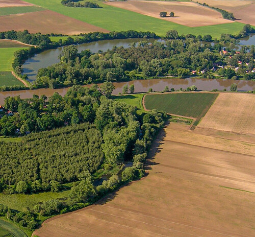
In the Czech Republic, the previously overlooked lateral migration is gaining attention from the State Nature Conservancy authorities, scientists, as well as River Basin Management Authorities and other watercourse managers. It is the movement of fish into the lateral watercourse ecosystems - shallows, pools, gravel beds/bars and of river dead arms/ backwater or oxbow lakes and ideally also beyond the river bed edge into flooded floodplain forests and meadows. Its restoration provides the ability to reduce invasive alien species numbers and to improve water quality and overall ecological conditions there. Promoting it with appropriate measures is therefore highly desirable also for implementing the European Union’s Water Framework Directive. For fish, migration is the movement of an individual for a specific purpose. This may be for reproduction, but it may also be for feeding, escape or shelter. Lateral migration is a type of migration defined by a direction perpendicular to the longitudinal axis of the stream. It is a relatively general term to describe a complex group of movements controlled by drivers either attracting or repelling fish to move to the bank or middle of the river. The most important factor in relation to lateral migration is the water column height, as increased flows create one of the most threatened ecosystems to which fish migrate exclusively laterally. There are not many sites/places where these ecosystems can be found in the Czech Republic’s landscape in the Czech Republic. Moreover, unmanaged streams are generally small watercourses, which are characterised by lower fish species diversity than large lowland streams.
Just T.: Favourable Flow Conditions
One of the tasks of watercourse management is the maintenance of favourable flow conditions (FFC). Unfortunately, in the Czech Republic even today many water managers still have had a simplistic, schematic and consequently incorrect view of FFC in the field. Wherever, irrespective of the fact that there are various conditions in different watercourse stretches and different objectives are to be applied there, they associate the idea of FFC with maximising the flow capacity of the watercourse bed. They are also supported by the idea generally held by self-government authorities in the country that a stream or river bed is generally better the more water it can hold, despite whether it is surrounded by houses or meadows, fields or forests. The greatest possible flow capacity is usually desirable in watercourse stretches in and near built-up areas and within reach of important structures. The protection of built-up areas, roads, utilities and similar buildings is a socially recognised priority. To protect these interests, flow capacities shall be maintained at high flood flows. In the built-up areas in municipalities, a perimeter flow capacity of Q100 - “100-year water” - is commonly considered desirable, often even being greater. However, what applies in built-up areas is not at the same time the general standard in the open, undeveloped landscape. On the contrary, spills outside the watercourse bed must be supported because of the flood wave decreasing and flattening there.
Frei I., Jílková V., Kotyzová M., Laštůvka Z., Malenovský I., Musíl Z., Pižl V., Řehová V., Starý J., Straková M., Šefrová H., Tajovský K., Tůma J., Vašíček M. & Vymyslický T.: Study on Grassed Sites in the Moravský kras/Moravian Karst Protected Landscape Area
The Moravský kras/Moravian Karst Protected Landscape Area (PLA, South Moravia) was newly declared in 2019. In addition to the change in boundaries and new more detailed protection/conservation conditions, the delineation of nature conservation zones has also changed. The main reason for the zonation change on karst plateaus was to limit erosion into sinkholes and leaching of fertilizers and pesticides into the karst underground. A total of 114 hectares of arable land was grassed in 2019-2020. Most of them were sown with a subnational/regional or species-enriched grass mixture, which the Nature Conservation Agency of the Czech Republic (NCA CR) contributed financially to. In 2019, the grassing was followed first by a one-year study carried out by the NCA CR and funded by the Landscape Management Programme and then in 2020-2023 by a four-year study within the Landscape Natural Function Restoration Programme (LNFRP) entitled as “Monitoring of above-ground and soil biota of grasslands of karst plateaus in the selected areas within Zones I and II of the Moravský kras/Moravian Karst Protected Landscape Area”. Grassing over caves and around sinkholes contributed not only to the protection of karst ground and water from pollution, but also to the dividing of the farmland into smaller parts. Thus, the islands of greenery on arable land have been hosting a variety of wild animals and plant species, including rare weed species, which are indicators of nature-friendly agriculture and contribute to increasing local biodiversity. Surveys have shown the importance of proper selection of seed mixtures at various sites for preserving plant gene pool there. Comparison of outputs basic inventory results gathered from different groups of organisms and changes in soil features provided the basis for more detailed comparisons between grassland and arable land types.
Research, Surveys and Data Management
Ouhrabka V.: Using Georadar in Karst Areas and for Cave Surveys
Caves defined as underground holes of natural character are the main subject of speleological surveys. The first systematic speleological surveys had been conducted on what is now the Czech Republic as early as 300 years ago aiming mainly at passing through freely accessible, mostly known caves, their description and at basic documentation (maps and drawings). Only later, during the 19th century speleological survey intentionally began to deal with finding and discovering new caves. Modern technology allowed to penetrate to new caves by digging through massive cavings, corridors filled by sediments, rock narrows and water siphons/sumps or to climb up through high colouirs. Georadar, a device allowing to determine interfaces between the individual materials in the bedrock provides a new method to looking under the Earth’s surface. According to technology applied and character of the bedrock it is able to look hundreds of meters under the ground because it operates on the principle of transmitting and reflecting short duration electromagnetic pulses from a transmitter. A reflected wave is composed of received impulses. A special software can display the wave at any point of measuring and to assemble a whole radargram from the individual waves. The first remarkable success related to testing the georadar in seeking for yet unknown cave corridors was made by Slovenian speleologists in early 2019. Based on measuring in the vicinity of the Škocjan Caves possible directions and depths of further continuation of known cave spaces had been identified. Consequently, by digging to the depth of about 90 meters under the surface the speleologists really entered in new caves. Thus, georadar survey helped to made the first great discovery in the Škocjan Caves after almost one hundred years.
Fránková M., Soukupová M. G., Bobek P. & Kulichová J.: Phycological and Paleoecological Research of the Selected Mineral Springs in the Slavkovský les/Slavkov Forest Mts. Protected Landscape Area (West Bohemia)
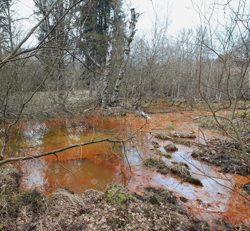
The Slavkovský les/Slavkov Forest Mts. Protected Landscape Area was established in 1974 for its exceptionally well-preserved water regime including numerous mineral springs. Since 2012, the mires and springs have been classified as Wetlands of International Importance by the Ramsar Convention. In 2021 the authors conducted phycological and paleoecological research of several springs. They studied the recent biota with a focus on microscopic unicellular algae - diatoms. The authors found species rich assemblages (altogether 103 taxa) with a significant percentage of national Red List taxa. The flagship species of the local iron springs was Pinnularia ferrophila. In order to determine whether the endemic species inhabits the mineral springs in the long term, sedimentary cores collected near the springs were examined. Through the oldest sediments (Novoveská kyselka and Číhaná), the authors were able to look into the wetlands’ history dating back to the end of the Last Ice Age (13,000 years). The scientists found Pinnularia ferrophila in fossil as well as in modern samples at two sites: in the deepest sediments of Číhaná and also Kramolínská kyselka. The fossil diatom assemblages displayed species richness (111 species) similar to the contemporary ones and national Red List taxa were also found among them. As part of the palaeoecological research, the authors also studied other proxies (pollen grains and macrofossils) that helped to reconstruct past changes in the local landscape.
Plesník J.: Conservation Genetics Has Been Helping Nature Conservation and Landscape Protection more than a Half of Century
Genetic diversity describes variability in succession of bases within the nucleotides forming alleles within a DNA or RNA molecule, and traits within a species. Therefore, it always is intraspecific. Thus, it refers to the heritable variations between individuals and populations coded within DNA. The combined differences in the DNA of all individuals in a species make up the genetic diversity: in other words, it is the unique genetic makeup of each individual, which is determined by DNA. Genetic diversity allows species, communities and ecosystems to adapt to the environment, resist negative disturbances and to develop themselves: thus, it is the necessary precondition for evolutionary changes. At the same time it significantly supports maintaining ecosystem processes, functions and services and provides human society with a lot of possibilities how to increase productivity in agriculture, forestry and fishery. The main drivers of genetic diversity decline/loss include natural habitat fragmentation, degradation, destruction and loss, overexploitation of populations by humans and climate change. All the factors can decrease abundance in populations and reduce space inhabited by them (demotope). The article briefly summarises the current knowledge of the topic including rapid advances in genomics.
Šindelář J.: Koněpruské jeskyně/Koněprusy Caves Scanning
In underground space 3D scanning a joint project called characteristically the Koněpruské jeskyně/Koněprusy Caves 3D scanning was carried out jointly by Geo-cz and the Cave Administration of the Czech Republic in 2023. A substantive part of upper and middle floor of the Koněpruské jeskyně/Koněprusy Caves (Central Bohemia) was scanned by terrestrial laser scanners made by Faro and Trimble companies. At the same time, data provided by spheric videogrammetry were also gathered there. After completing an accuracy test it can be stated that spheric videogrammetry at fixed values of the elements is an accurate enough, detailed, very quick and low-cost method. Therefore, it was consequently applied in documenting all hardly accessible sites in the Koněpruské jeskyně/Koněprusy Caves. A lower floor of the Koněpruské jeskyně/Koněprusy Caves consists of 360 meters of abysses and corridors of very small size, which should be crawled. Checking accuracy of the low floor scanning is through points locked on the surface close to an entry into underground space and location of the chimney in the southernmost part that was locked from the surface in the second half of the 20th century. During only five days, parts of the Koněpruské jeskyně/Koněprusy Caves having been known yet were scanned. In total, 200 meters of the upper floor, 1,700 meters of the middle floor and 350 meters of the lower floor were documented.
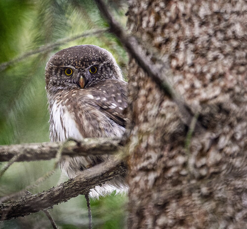
Havelka J.: Owls in the Brdy Highlands Protected Landscape Area
Extensive Norway spruce stands with dispersed hollow trees in the Brdy Highlands Protected Landscape Area (Central Bohemia) offer suitable conditions for occurrence of rare boreal owl species – the Boreal owl, also known as the Tengmalm’s owl (Aegolius funereus) and the Eurasian pygmy owl (Glaucidium passerinum). Moreover, the conditions have significantly changed by extensive salvage cutting there. The study presented aimed at response of both owl species to the changes. The owls’ occurrence was examined by acoustic monitoring using automatic recorders in the period of their highest acoustic activity. In total 402 records made across 235 km2 of the area were analysed.
Boreal owl territory density was estimated at 2-4/10 km2 (53-83 territories) while for the Eurasian pygmy owl it was 1.3-2/10 km2 (32-57). From a point of view occurrence of the above species, the Brdy Highlands are a significant area. Based on the findings, future of the Boreal owl that prefers open clearings for foraging for prey is not significantly threatened by salvage cutting there. On the other hand, the Eurasian pygmy owl avoids the clearings. Therefore, it is important to monitor the owls also in other areas with similar environmental conditions.
Hauck D., Konvička O., Venkrbec T., Marek J., Šácha D., Barcíková S., Čížek L. & Veselý M.: Monitoring of the Alpine Longhorn Beetle (Rosalia alpina) in the Vlára River Pass Special Area of Conservation
In the northern part of the Bílé Karpaty/White Carpathians Mts. Protected Landscape Area, the Vlára River Pass Site of European Importance (SEI, pursuant to Act No. 114/1992 Gazette on Nature Conservation and Landscape Protection, as amended later, the term for Site of Community Importance, SCI, later Special Areas of Conservation, SAC, under the European Union’s Habitats Directive) is located. The Alpine longhorn beetle, also known as the Rosalia longicorn (Rosalia alpina) is one of the nature conservation targets there. In 2021 the Nature Conservation Agency of the Czech Republic commissioned the beetle’s monitoring to be carried out there aiming at gathering detailed information on the species. Due to mark-recapture method applied it was found that the population size is more than 3,000 individuals, of them about one quarter being females. Species’ mobility was also studied. In total there were 12 movements by flights longer than one kilometre, the longest reaching 3,300 meters. Research also showed that there is an important subpopulation west of the SEI/SAC, consisting of approx. one fifth of the individuals and that there are movements by flying between the Czech and Slovak Alpine longhorn beetle populations. Among non-target species found during the study, critically endangered longhorn beetles Necydalis ulmi a Stictoleptura erythroptera should be mentioned. Comparing aerial photographs from 2006 and 2018 demonstrated that 34.5% of old European beech (Fagus sylvatica) growths were logged within the SEI/SAC in 12 years only. Based on outputs of the research management was proposed consisting of non-intervention approach, selected management, increase in dead wood amount, increase in numbers of reserved solitary trees intentionally left on clearings and particularly of trimming trees.
Klečková I., Kozel P., Kolář V., Tájková P., Ribeiro P., Linke D., Matos-Maraví P. & Sucháčková Bartoňová A.: Genomics in Insect Conservation: Challenges and Possible Use
Maintaining the highest genetic diversity of the species reflected by large and stable population sizes is a principal and traditional approach in conservation genetics. Genomic research can be applied in studying population structures, even at the very detailed scale. Such analyses allow to gather information on structure of the studied populations, their sizes and on barriers limiting exchange of individuals among them. Past changes in the population sizes can be estimated and researchers can also find which populations have been declining and whether the decline is a long-term trend or a fluctuation even when the fact is not at first sight clear from field observations. Thus, genomic techniques help to examine causes of decline in some insect species surviving only in isolated populations. They also allow to reveal dynamics of and connectivity among populations in the landscape that makes establishing a network of suitable habitats easier there. Last but not least, we can support declining populations or those on the brink of extinction by restocking them by individuals from suitable viable populations. At present, climate and habitats have been changing so quickly that wildlife translocation become more and more important in nature conservation. In some threatened butterfly species, assisted colonisation has been suggested. Genomics allows to estimate the number of individuals of the target species necessary for successful re-introduction. Finally, identification of unique populations supports to justify their protection, conservation and management also among land owners and land managers. Therefore, genomics shows a clear prospect in relation to proposed amendments to Act No.114/1992 Gazette on Nature Conservation and Landscape Protection because pursuant them not the individual but just populations shall be protected, conserved and managed.
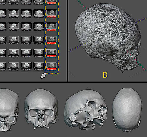
Drbal K.: Forensic Facial Reconstruction of the Mladeč I Skull
Current research techniques not only give precision to opinions on some questions related to human evolution in Europe, but in many cases, they result in whole and principal rethinking of the questions. It was also the case of a finding from the Mladečské jeskyně/Mladeč Caves (Central Moravia). Facial reconstruction of the Mladeč I skull was selected to improve currently used techniques. In data gathering also the Naturhistorisches Muzeum/Museum of Natural History Vienna was involved: the skull was deposited there. Nevertheless, the skull itself is not complete which complicated the facial reconstruction. Fortunately, the Naturhistorisches Museum Vienna had made the online version of the Mladeč I crania available under the Creative Commons license (CC BY-NC 4.01). The model became the principal input for the facial reconstruction. Consequently, 2,753 images were generated, of tem 83 were separated for views and as a basis for the photogrammetry. A further step was reconstruction of skull’s missing parts, namely mandible (lower jaw) and teeth. In order the facial approximation to be carried out, the skull must be complete and, in view of this situation, it was necessary to conduct a reconstruction of the missing parts of the structure. Before beginning the work to recover the missing regions, some measurements were taken on the skull to be approximated, in order to locate virtual donors that would serve not only for recovery, but also for the subsequent process of facial approximation. Measurements were made of the spaces between the orbital frontomalars, between the glabella and the nasion, and between the rhinium and the most extreme lateral edge of the orbit. These data are plotted on a graph of population clusters, indicating affinities with tomographies that may be in the authors’ virtual donor collection. In the case of the Mladeč 1 skull, there was greater affinity with clusters of Asians, general Brazilians, and Brazilians of markedly African ancestry. This positioning is not definitive evidence that it is an individual from those ancestral groups, but that there is a compatibility of the eye and nose region with individuals from the clusters.
Václavík T., Čejka T., Bednář M. & Šarapatka B.: Agri-environment Approaches in Farmland
Intensive agriculture significantly contributes to biodiversity decline and loss and the degradation of ecosystem services in Europe’s landscapes. Agri-environment approaches have been introduced as a tool to mitigate the negative impacts, but their effectiveness and the extent to which they are used by farmers varies widely. The European research project entitled as BESTMAP (Behavioural, Ecological and Socio-Economic Tools for Modelling Agricultural Policy) aimed to develop a methodological framework for modelling the impact of Agri-environment Schemes (AES) on farmland. The project’s methods take into account the complexity of farmers’ decision-making and the various preferences of different farm types. At the same time, the project assesses the impact of different AES implementation scenarios on biological diversity and ecosystem services in five case study areas across the European Union, including the Czech Republic, namely in the South Moravia and Zlín regions. Thus, the results of the BESTMAP project show that AES can contribute to the conservation of biodiversity and environmental components, but their current implementation has been insufficient to achieve significant positive impacts. To increase their effectiveness, the diversity of farms, farmers’ motivations and the comprehensive relationships between farming practices and the environment need to be taken into account. However, it is essential to emphasise that effective biodiversity conservation requires a comprehensive approach that goes beyond AES alone and involves wider changes in farming practices and landscape planning.
Prach J., Hájková P., Vondrák D., Dudová L., Marešová P., Bobek P., Chattová B. & Pokorný P.: Research on Ecosystems’ Past – What Can Paleoecology Offer to Current Nature Conservation?
Research on peat-bogs, lakes, fishponds, cave interiors, etc. step-by-step builds up an idea of the past in the Czech Republic’s territory. Botanist, zoologist, geologist, archaeologist, data analyst and many others meet at one excavation site or at the evaluation of the results. The picture that emerges is the one that textbooks and various maps present to practical conservationists, foresters, landscape planners and similar applied professions. Moreover, the situation is not as clear and simple as it appears e.g. in the tables within the Specially Protected Area management plans. There is no single ‘natural’ or ‘natural’ state that contrasts with the human-altered state of the area and could be an unquestionable target for protection, conservation or restoration. Nature has always been changing, species have been migrating or dispersing across the landscape and have been becoming extinct in some areas. For millennia, moreover, this has happened in inseparable interaction with humans. Not one such change can be seen and studied live, but many similar changes have taken place in the past. In Central Europe, the influence of man in shaping even what we have nowadays used to call natural habitats has increasingly been becoming evident. Understanding such a development is a good basis for accepting the need for active management of protected areas and protected species. It is then more a political decision as to which areas we want to maintain e.g. in the state of the 19th century cultural landscape (meadows), which in the era before introducing modern forestry measures (e.g. grazing and coppice forests) and which should be experimentally without man (primary/virgin forest reserves) or where we want to highlight some ecosystem services provided also by a habitat with a species composition having no analogy in the past.
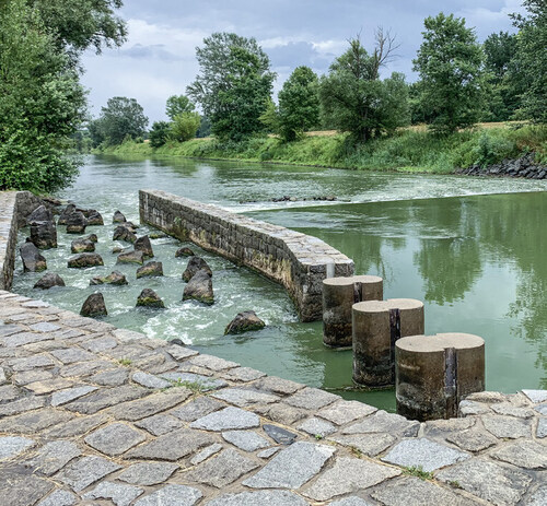
Borovec J. & Pixa J.: The Water Quality in the Nové Mlýny Waterworks and in the Dyje/Thaya River Downstream (South Moravia)
In the Czech Republic, the water quality in the rivers is not good. Neither is the quality of aquatic ecosystems good, as shown by the regular assessment of their ecological status under the European Union’s Water Framework Directive. Certainly, compared to the state of the rivers at the end of socialism in the late 1980s, the current situation is “orders of magnitude better”. However, the most noticeable improvements occurred as early as in the early 1990s and looking at nutrient concentrations in streams over the last 20 years, for example, any significant decline could not be found. Experimental results show that all sediments are significantly removing oxygen from the water, and the sediments in the Nové Mlýny Waterworks Middle/Věstonice Reservoir (South Moravia) are also absorbing nitrate and releasing ammoniacal nitrogen massively. In terms of phosphorus, the release from sediments in the Upper and Middle Reservoirs is significant. It seems as if the Lower Reservoir does not change the water much anymore and releases what it has “inherited” from the reservoirs above it into the Dyje/Thaya River down the river. The Nové Mlýny Waterworks and the Dyje/Thaya River is a huge system that cannot be solved by one partial action only. Therefore, many partial actions, careful planning and compliance towards the desired improvement are required there. There also are opportunities once in the century, such as the crossing of the D52 road in front of the Upper Reservoir or compensatory measures on the water level fluctuations at the Middle Reservoir. Both actions provide critical opportunities for improving the Nové Mlýny Waterworks ecosystem and must not be implemented in a purely “engineering-technological” manner. Within both actions, measures can be carried out to reduce the Nové Mlýny waterworks’ trophic level and the consequent decrease in phytoplankton biomass and to slow down the processes associated with its decomposition.
Nature Conservation Legislation
Jelínková J.: Reducing Competence and Powers of the Czech Environmental Inspectorate
By the 15th subsection of Act No. 465/2023 Gazette changing Act No. 416/2009 Gazette on Accelerating Building of Transport, Water and Energy Production and Consumption Infrastructure and Infrastructure of Electronic Communication (Linear Infrastructure Act), as amended later, and other related laws, Act No. 114/1992 Gazette on Nature Conservation and Landscape Protection (ANCLP) was amended. The changes mainly deal with competences and powers of the Czech Environmental Inspectorate (CEI) that shall not deal with natural persons not doing business anymore. The reduction of CEI’s powers was done through a Members of Parliament amendment not related to the Linear Infrastructure Act topic. Thus, comments of other State Nature Conservancy authorities including those of municipalities and Regions or environmental citizens’ associations were excluded. The reduction is caused by changes in the first sentence of Article 80 of the ANCLP pursuant to it the CEI lost competence for checking and consequently pursuant to Article 80 paragraph 4 of the ANCLP for dealing with natural persons’ offences. There is no transitional regulation/temporary provision within the amendment, i.e. the CEI has to hand over proceedings on an offence, which had begun before the amendment entered into force, to other State Nature Conservancy authority having been continuing to be authorised to deal with them, most often to municipality with extended powers (MEP), alternatively to the Nature Conservation Agency of the Czech Republic. Therefore, workload will increase in Municipal Offices of MEP and other State Nature Conservancy authorities, although they have been dealing with supervising agenda rather optionally. Due to their heavy overloading with permission activities under pressure of the very strict deadlines which shall even increase by issuing the Unified Environmental Opinion pursuant to the New Building Act it is not realistic that they will be able to provide more capacities for checking, preventive and sanctioning activities than they have to date done. Thus, rights for nature conservation and landscape protection shall probably be reduced by revocation of natural persons not doing business from the competence of the CEI, a specialized checking and enforcement authority with more than thirty-year experience and tradition in the Czech Republic.
Pešout P. & Kinská dal Borgo J.: Changes in Payments of Compensation for Losses Caused by Nature Conservation Provisions in Agriculture, Forestry and Fishpond Management
In the Czech Republic, there have been payments of compensation to owners for loss caused by nature conservation provisions in agriculture, forestry and fishpond management for twenty years. The legal framework for the compensation payments is set by two implementation decrees which have recently been significantly amended. The methodology for assessing legitimacy and amount of compensation has been developed and specified. Except of areas managed by the respective National Park Administrations, financial compensation payments is managed by the Nature Conservation Agency of the Czech Republic across the whole country’s territory. By introducing the scheme in 2004, the Czech Republic joined many European countries where losses to owners caused by nature conservation are in various extent compensated. Step by step, payments of compensation for complications in agriculture, forestry and fishpond management have become one of the most important financial tools of the State Nature Conservancy in the Czech Republic. Although the amount of finances demanded has been year after year increasing it has not reached the estimation made during introducing the scheme into amendment to Act No. 114/1992 Gazette on Nature Conservation and Landscape Protection twenty years ago.
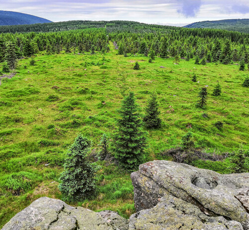
Havel P.: Czech National Nature Restoration Plan
Since the European Commission presented proposal for a European Union’s regulation on nature restoration (Nature Restoration Law, NRL) almost two years have passed. During that time, a compromise on the NRL’s content was finally reached. In the case of natural habitats, it includes exception allowing to reduce nature restoration targets in common types of natural habitats or in recreated natural habitats. The provision on pollinator population recovery was also changed, namely in relation to the extent of obligatory monitoring. Consensus on restoration of agricultural ecosystems offers a possibility to select two of three indicators, in the case of forest ecosystems six from seven indicators given by the NRL. There is no duty for the EU Member States to change financing from the Common Agricultural Policy and the Common Fishery Policy for 2021 – 2027 when implementing the NRL through National Nature Restoration Plans (NNRP).
The last necessary step is approving the proposal on the NRL by the Council of the European Union. Consequently, a key tool is NNRPs allowing the Member States when applying the NRL to take into account specific natural and socio-economic conditions, to set priorities and activities in nature restoration and to quantify them.
Kosejk J.: Impact of Changes in the Building Act on State/Public Administration Performance in Specially Protected Areas
In 2024, Building Act recodification introducing an issuing the Unified Environmental Permission (UEP) does not include Specially Protected Areas and Natura 2000 sites in the Czech Republic. In these areas, the respective State Nature Conservancy authorities (SNCA) integrated under the UEP issue the so-called SNCA joint decision in which they assess the intention requiring the UEP from a point of view of all interests. Moreover, since July 2024 the legislative changes shall cause an extreme increase in workload in Specially Protected Area Administration staff that should be urgently reduced by a set of various measures.
Therefore, the Nature Conservation Agency of the Czech Republic (NCA CR) has initiated a set of legislative, methodological and administrative measures to reduce a bureaucratic load within the Building Act implementation in National Parks and Protected Landscape Areas. From a long-term point of view, it aims at actively influencing planning documentation developers in National Parks and Protected Landscape Areas to elaborate land-use/territorial plans with the given regulatory elements or regulatory plans. For planning documentation developers, the NCA CR has been preparing financial incentives from subvention programmes/subsidy schemes for the activities.
Mach P. & Škorpíková V.: Some Thoughts on Necessity to Change Setting Species Protection Exemptions
Legislative protection of specially protected wild plant and animal species is restrictive in the Czech Republic. It is based on protection of individuals by restricting activities negatively impacting their natural development. Formal requirements follow from provisions of Act No. 114/1992 Gazette on Nature Conservation and Landscape Protection. As amended, if an exemption is not issued in the interest of nature conservation, another public interest of the intent prevailing over the interest of nature conservation has to be clearly proved. When reviewing the decision on exemptions, meeting the above formal requirements is strongly emphasized. According to the judicature, the burden of proof of meeting them lies with the applicant. Consequently, the decision-making State Nature Conservancy authority should assess whether the arguments provided by the applicant are in this respect sufficient. Following judgements, the decision-making bodies have to look into whether public interest on the intent representing all-of-society value worth of special protection is met. By its very nature, exception from species protection is not a tool serving to solve systemic issues related to measures applied in a blanket manner and their negative consequences for nature caused by industry, transport, agriculture or forestry. Provisions to control such activities should be accepted conceptually when main executive, management and legislative bodies and of course experts participate in.
Focusing on the Public
Plesník J.: On IUCN Lists. This Time on Green Ones
The International Union for Conservation of Nature (IUCN) is sometime accused that through well-known Red Lists it excessively highlights unfavourable status of global nature. Therefore, an idea to award from a point of view of nature conservation important and well protected, conserved and managed protected areas has resulted in the idea of the IUCN Green List of Protected and Conserved Areas. A protected or conserved area or Other effective area-based conservation measures (OECM) that reaches the IUCN Green List Standard is certified and recognised as achieving ongoing results for people and nature in a fair and effective way. Any site can join, and work its way towards achieving verified success, and then maintain the Standard or further improve. More than 600 individual protected areas or OECMs have been involved in the IUCN Green List of Protected and Conserved Areas campaign. Moreover, not all have been obtained the certificate of inscription on the Green List. As of 1 January 2024, there were 61 protected areas or OEMs on the list: in total, they cover 735,551 km2, i.e. 0.4% of the Earth’s surface. An intention to present to the professional and general public species or other taxa, due to effective conservation measures saved from extinction, has not been quite new. For elaborating Red Lists and Red Data Books IUCN used also the category Saved in 1987 to 1994. After the 5th World Conservation Congress IUCN begun to develop the IUCN Greem List of Species. After a series of consultations conducted in 2012 – 2018 the conceptual framework of the IUCN Green List of Species was proposed and it was decided to call the new measuring species recovery the IUCN Green Status of Species to avoid confusion with the above IUCN Green List of Protected and Conserved Areas. Species is fully recovered if it is present in all parts of its range, even those that are no longer occupied but were occupied prior to major human impacts/disruption, it is viable (i.e. not threatened with extinction) in all parts of the range and it is performing its ecological functions in all parts of the range. The IUCN Green Status of Species, a set of metrics designed to characterize the past and potential future recovery of each species on the Red List, was festively launched at the opening of the 7th World Conservation Congress held in Marseille, France in September 2021.
Jongepierová I. & Říhová J.: The White Carpathian House of Nature
In the end of 2023, the Bílé Karpaty/White Carpathians Mts. Protected Landscape Area Visitor Centre – The White Carpathian House of Nature (BK-WCHN) was approved in Bartolomějské náměstí/Bartholomew Square in the historic quarter of the town of Veselí nad Moravou (South Moravia). An investor and an operator of the BK-WCHN is the Czech Union for Nature Conservation Bílé Karpaty/White Carpathians Mts. The site was selected also due to good connection by public transport to the PLA’s southern part as well as the fact that lively tourism on the Baťa Canal and on adjacent bike trails provide plenty of visitors there. Design of the facility begun as early as in 2016. In 2020 – 2021 there were some tenders for BK-WCHN’s building, equipment and furnishing: some of them had to be repeated. Finances were provided by the South Moravian Regional Office and the Town of Veselí nad Moravou and small contributions were donated by some municipalities. The original building in Bartolomějské náměstí/Bartholomew Square was completely restored. On the ground floor, there is a reception and exposition, while on the 1st and 2nd floor a lecture theatre, a library and offices for operating the BK-WCHN can be found. The other building is a passive new construction where a part of the exhibition is located on two floors. An atelier is available there not only for activities with children but also for various workshops and training courses. The whole BK-WCHN’s exhibition puts on playfulness and creativity. Zoya Volkova’s drawings on blueprint background are complemented by photos and movies as well as by a series of animations. All texts were translated into English and German. Adjacent winter outdoor space can also be used for various purposes, too. A water element – the Morava/Moravia River with meanders shows illustratively how water can be retained within the landscape and aims at children. The BK-WCHN will be festively launched in March 2024.
Hofmeisterová H., Hromas J. & Pojer F.: The Český kras/Bohemian Karst House of Nature Launched
Priorities of the Nature Conservation Agency of the Czech Republic (NCA CR) also include communication with, education of and awareness among the general public and the target groups. Without it, it is not possible to effectively and over a long period protect, conserve and manage nature and the landscape in the country. Protected Landscape Areas (PLAs) harbour natural and cultural heritage of national and international importance. Some of them are a part of the UNESCO World Network of Biosphere Reserves, Wetlands of International Importance (Ramsar Sites) or UNESCO Global Network of National Geoparks/Global Geoparks. Traditionally, they are among the most important and the most attractive tourist destinations in the Czech Republic. The Český kras/Bohemian Karst House of Nature has been the twelfth established by the NCA CR. The Cave Administration of the Czech Republic in close collaboration with the NCA CR, namely the Český kras/Bohemian Karst PLA Administration built a multifunctional facility within the Koněpruské jeskyně/Koněprusy Caves in the Zlatý kůň/Golden Horse National Nature Monument (NNM) located in Central Bohemia. It will serve to visitors to the Koněprusy jeskyně/Koněprusy Caves and the Český kras/Bohemian Karst aiming at helping them to perceive importance, beauty as well as vulnerability of the landscape there and to offer to them a possibility to contribute to its protection and preservation. The House of Nature building contains an exhibition, a multifunctional hall, a playroom, usual utility rooms for visitors (sanitary facilities, a sandwich bar and a shop) as well as modern working space for the Koněpruské jeskyně/Koněprusy Caves Administration. There is an adjacent outdoor exhibition and an educational path through the Zlatý kůň/Golden Horse NNM and its vicinity. In three parts, the exhibition in the House of Nature presents to visitors geological patterns of the Český kras/Bohemian Karst, origin, development and importance of karst phenomena and, of course, Český kras/Bohemian Karst PLA’s biota: technical parts of the exhibition are complemented by playground equipment, quizzes and riddles dedicated not only for children.
Loučková B., Tichopádová E., Stella D., Drlíková J., Martinovská A., Zvěřinová S. & Vačkářová D.: Participatory Ecosystem Service Assessment
One of the ways how to present to the society importance of benefits provided by nature not only for human life, but also for society well-being and economy is their assessment – identification and quantification. Within the EU LIFE project One Nature the authors organized a series of participatory workshops in three Protected Landscape Areas (PLAs) in the Czech Republic, namely Třeboňsko/Třeboň Basin, Křivoklátsko and Slavkovský les/Slavkov Forest Mts. in 2022-2024.
In each PLA four workshops were held aiming at assessing significant nature’s contributions to people and their mutual relationships by socio-cultural assessment. During a group discussion, the participants selected relevant nature’s contributions for the given area and consequently they placed the contributions on four-grade scale according to importance of its occurrence. In a further step, in the most important nature’s contributions the extent of their providing by the individual ecosystem types at the sites was assessed. Data from matrixes describing the relationship among the most significant ecosystem services were then analysed and cartographically visualized through ecosystem service hot spot and cold spot maps in all the three PLAs.
Miklín J. & Kmet J.: On the Pavlov Hills, Their Beauty and Diversity
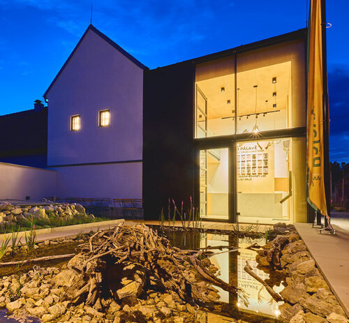
Since 2024, the Pavlov Hills Protected Landscape Area (PLA) has had its visitor centre – the Pavlov Hills House of Nature that was built by rebuilding and completion of the former archaeological museum at the village of Dolní Věstonice (South Moravia). An exposition having the Eurasian hoopoe (Upupa epos) as a mascot presents the Pavlov Hills colloquially called Pálava as an area displaying extraordinarily high species richness as well as a long-term coexistence between humans and nature. An idea to use the museum’s historical building at Dolní Věstonice had for the first time emerged in 2016 and in 2017 it was elaborated into a conceptual intent. The background for the establishing the exposition was the document entitled as Strategy for Visitors in the Pavlov Hills PLA, which also includes the Pavlov Hills House of Nature Outline. The latter defined the main aim of the exposition as follows: Through the exposition and services in the Pavlov Hills House of Nature to help visitors to perceive importance, beauty, but also vulnerability of the Pavlov hills landscape, to appreciate its uniqueness and efforts paid to protection, conservation and management of the area by the State Nature Conservancy authorities, managers, municipalities, museums and other bodies as well as local people and to inspire visitors to support conservation of natural and cultural values by their behaviour there. Based on the above, experts developed the up-to-date, interactive and varied exposition. Its motto welcoming visitors is On the Pavlov Hills, their Beauty and Diversity and Responsibility of Humans for Their Fate. Preparatory work started in 2017 and an application for subvention was submitted within the Operational Programme Environment (OPE) in November 2018. Just in 2019 developing movies, exhibits, texts and design began. Particularly construction had to be delayed due to various administrative difficulties so the construction itself started in early 2023. the exposition was finalised in spring 2024 and the House of Nature was launched 14 June 2024: in the event Mr Petr Hladík, Minister of the Environment of the Czech Republic and Mr Jan Grolich, President of the Regional Council of the South Moravian Region participated.
Zajíček P.: Na Turoldu Cave, the Largest Karst System in the Jurassic Limestones in the Czech Republic
The Na Turoldu Cave (South Moravia) itself has a total length of 1,650 metres, of which 280 metres are open to the public as a show cave. The tour takes about 40 minutes and the air temperature is 7-100C. The relative humidity is lower than in normal caves, namely 70-90%, so the underground spaces give a dry, dusty impression. The tour starts in the Stará síň/Old Hall, where the typical character of the space with massive broken boulders is already visible. The route continues in depth past areas with needle and stick-like sinter decorations to the Balvanitý dóm/Boulder Dome, which was formed at the crossing of tectonic fissures. Another steep staircase leads visitors to other lower areas. The walls and ceilings are covered with the typical Turold decoration mentioned above. The system of spaces flows smoothly into the Netopýří dóm/Bat Dome. The Na Turoldu Cave is the largest wintering ground/hibernaculum for bats in South Moravia. The most numerous species is the Lesser horseshoe bat Rhinolopus hipposideros), which winters there every year in numbers of approx. two hundred individuals. Branches from the Netopýří dóm/Bat Dome lead to the Síň konce/Hall of the End, where a small geological and mineralogical exhibition is installed, then to the Jezerní dóm/Lake Dome and finally to the Pohádková síň/Fairy Tale Hall. Visitors then take the same route back. The cave is open from April to mid-November. It is located in the 16.84 hectare Turold Nature Reserve, which is part of the Pálava/Pavlov Hills Protected Landscape Area and Biosphere Reserve.
Kotecký V.: Corporate Sustainability and Czech Nature Conservation
Every January, the World Economic Forum (WEF) publishes a major survey asking hundreds of respondents from global business to estimate the risks they will face in the next decade. Unsurprisingly, standard economic themes often dominate in the responses. However, a new and somewhat unexpected item has been rising up within the rankings for several years. Surprisingly, it is biological diversity decline and loss. It has already ranked as the third strongest medium-term risk to business in the 2024 WEF’s survey. Business clearly thinks that biota (a living part of an ecosystem) is not only socially important, but also displays specific practical consequences for financial performance. Traditional perceptions of biodiversity and ecosystem services have been rapidly changing in the senior management of large companies. Therefore, nature conservation is being given a new instrument that can be used effectively in the Czech Republic - and in particular for practical measures to promote biodiversity in agricultural, forest and urban landscapes provided, of course, that it offers solutions that meet the needs and possibilities of businesses. The main benefit of corporate interventions is the leverage effect shifting the market environment. For the time being, agricultural and forestry enterprises deals with purely production incentives. If strong commercial buyers start to demand and seek for biodiversity concerns as well, better conditions may open up for suppliers over time, e.g. for more environmentally friendly cultivation practices. This is an agenda quite far from traditional nature protection, conservation and management. However, in the landscape predominantly used for commercial farming the state of biodiversity is derived from market incentives.
From the History of Nature Conservation
Zajíček P.: Karel Absolon’s Expedition to the Macocha/Stepmother Abyss Bottom in 1903
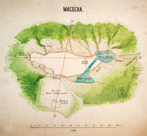
Until 1914 the bottom of the Macocha/Stepmother Abyss in the Moravský kras/Moravian Karst (South Moravia) was available only from above using ropes or ladders. From the first climbing down the abyss conducted in 1723 there were many other adventurous expeditions or scientific surveys in the otherwise inaccessible sites. At the beginning of the 20th century Karel Absolon organized in total five climbing down the Macocha/Stepmother Abyss. One of the most important expeditions was conducted in 1903. The participants, six explorers and six workers, had a bivouc with all equipment at the bottom and spent in total four days and three nights there, raising a lot of new knowledge and discoveries. The main reason for organising the expeditions were possible discoveries of new spaces between the Macocha/Stepmother Abyss bottom and the Pustý žleb/Desolate Canyon that had been expected there.. During the expedition, temperature, humidity and pressure were measured at the abyss’ bottom. Nevertheless, a publication presenting the measurements has not been found yet. Although the expedition did not reach the current Punkevní jeskyně/Punkva Caves, new small caves, inter alia, the Pasovsky’s Cave, were discovered. František Straňák, a botanist, also participated in the expedition: he in detail analysed vegetation cover over the bottom and on accessible parts of walls. Two years later, Absolon organized a five-day expedition even with more participants. Consequently, he systematically planned a strategy for further speleological surveys there that resulted in discovering the first part of the Punkevní jeskyně/Punkva Caves underground system in 1909.
Svojanovský R. & Koudelka M.: Historical Development and Current State of Map Documentation of the Javoříčko Caves
The first serious information focused on individual karst phenomena of the “North Moravian Karst” was Josef Blekta’s map from 1932. The map depicted the then known surface karst phenomena, sinkholes and ponors, especially the Zkamenělý zámek/Petrified Castle, the Zátvořice Abyss and the Svěcená díra/Sanctified Hole Cave, which had been known since time immemorial and whose spatial connection had been speculated for decades. It was then that the systematic search for caves under Špraněk Hill really began. In 1937, during a targeted search for the continuation of the well-known Svěcená díra/Sanctified Hole Cave, new areas were discovered below it. Already in May 1937, the discovery was mapped in detail by František Meisl from the town of Plumlov, a student of the Mining University in Příbram (Central Bohemia). Even in the coming difficult war period, the discovery of other spaces under Špraněk Hill continued. Bedřich, the son of the game warden and district forest officer Švec, took the initiative and with his friends from the neighbourhood discovered and explored a number of new caves in the Javoříčský kras/Javoříčko Karst. After the end of the war, there was hardly anyone left of the original actors in the area to initiate new explorations and surveys. At that time, a strong movement of young, active and enthusiastic speleologists in the Moravský kras/Moravian Karst emerged. On 1 October 1958, the Regional Institute of Homeland Studies in Olomouc, later the Regional Museum of Homeland Studies, was founded and took over the management of the Javoříčko Caves. In 1957, Jaroslava Loučková-Michovská appeared in the Javoříčko Karst and in her dissertation she evaluated the whole Javoříčský kras/Javoříčko Karst’s territory from the geomorphological point of view and from the point of view of its possible genesis. She also introduced the nomenclature of karst phenomena that has been used up to now, hypothesized about the river flows that modelled the landscape and caves in the karst, and used for the first time rose diagrams of the caves’ main directions. In 2003, in connection with the resumption of speleological activities, there was a need to review the whole system. Of course, the technological progress in cave mapping has considerably accelerated; today it is possible to use 3D scanners, photogrammetry, and GIS for synthesis of various methods. But even these have their limits in the broken terrain, and it will always depend on the inventiveness of the person who draws the result to provide a really representative view of the site and the truest possible interpretation.
International Nature Conservation
Bobek M.: Conservation of Pangolins Requires a Broader Approach
Until recently pangolins (Pholidota) have been known only to those interested in tropical fauna or professional zoologists. With the exception of the abdomen, the body of these medium-sized mammals is covered by relatively large protective keratin scales: they are the only mammals having scales. Just an enormous demand for scales, meat and other body parts caused intensive poaching of pangolins at first in South and Southeast Asia and consequently also in tropical Africa. The Convention on International Trade in Endangered Species of Wild Fauna and Flora (CITES) has been trying to control international trade with all pangolin species, but with varying results. The scales are used in traditional medicine in East Asia as well as in Africa. In China the price of pangolin scales can reach USD 3,000 per kilogram. Pangolin meat is prized as a delicacy in parts of China and Vietnam: the consumption evidences wealth and social status there. Extensive demand for skin manufactured for exotic cowboy boots, wallets and belts has also contributed to a sharp decline in pangolins’ number. Pangolins occur or occurred in 53 countries: in almost all of them they are officially protected, often strictly. Cameroon has been an important centre in pangolin trafficking. Effective measures to save pangolins in the wild should cover the whole chain of poaching, trading and consumption: first of all, the demand should be reduced. The efforts should include not only restrictions, but also communication with, education of and raising awareness among the general public and the respective target groups. Captive breeding of pangolins has been extremely difficult because the animals do not adapt well to alternative or artificial foods and suffer stress, depression and malnutrition, leading to significantly shortened lifespans. In addition, they are extraordinarily susceptible to various infection diseases. Pangolins also lack some genes important for skin and mucosal immunity and for reducing vulnerability to stress. Therefore, rearing the female Chinese pangolin (Manis pentadactyla) called Šiška (Conex), the very first pangolin bred in Europe, in Prague Zoo in 2023 is really a great success on a global scale.
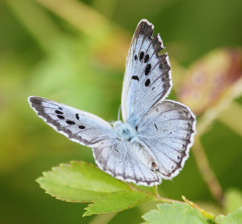
Urban P. & Miňová L.: Are UNESCO Biosphere Reserves in Slovakia Caught in Vicious Circle?
In 2021 the 50th anniversary of one of the most important intergovernmental programmes, the UNESCO Man and the Biosphere Programme (MAB) was celebrated. The programme aims at harmonious relationship between people and their environments. In practice it is implemented by the World Network of Biosphere Reserves (WNBR): as of 1 January 2024, there were 738 biosphere reserves (BR) in 134 countries including 22 transboundary sites, presenting a rich mosaic of ecosystems, cultures and nations and covering in total 5% of the Earth’s surface. Each biosphere reserve has three mutually reinforcing functions: conservation, sustainable development and logistic support for scientific research and education, Thus, they reserves are traditionally organized into three interrelated zones, known as the core area, the buffer zone, and a transition area or ‘area of cooperation. In Slovakia the following areas were awarded as biosphere reserve: the Slovenský kras/Slovakian Karst (1977), Poľana Mts. (1990), Východné Karpaty/East Carpathians (1992) and the Tatry/Tatras Mts. (1992). The latter was declared as bilateral while the Východné Karpaty/East Carpathians BR became the first trilateral biosphere reserve in the world in 1998. All four BRs overlap with Specially Protected Areas (three National Parks and one Protected Landscape Area). Since the beginning, attention has been paid to the BR’s conservation function while other two, particularly sustainable development one, lagged behind not only in monitoring, but also in communication, education and public awareness. Due to the ignorance of the mission and importance of biosphere reserves, the general public has been often considering them as further Specially Protected Area category with related restrictions. At present a comprehensive support from the State has been missing in implementing the UNESCO MAB Programme in Slovakia. The BRs’ management is coordinated by the State Nature Conservancy of the Slovak Republic Banská Bystrica. Elaborating and approving a national biosphere reserves development strategy should significantly enhance unifying targets and goals for future running them. Moreover, due to positive development in the Poľana Mts. Biosphere Reserve Vladimíra Fabriciusová, Chair of Slovak MAB Committee and Director of the Poľana Mts. Protected Landscape Area Administration was awarded by the international prize for the best management of a biosphere reserve in the world – the Michel Batisse Award for Biosphere Reserve Management in 2017.
Štěrbová J.: South Korean National Parks
South Kora covers 100,413 km2 and is populated by almost 52 million inhabitants. Korea National Park Service (KNPS) headquarters is located in Wonju, Gangwon province in north-eastern part of the country. The institution manages approx. one third of the country’s step by step declared protected areas, aiming at all 23 National Parks having been declared yet. In South Korea, National Parks cover totally 6.6% of the country’s territory and due to high human population density there, they are located particularly in mountain and coastal areas. South Korea has become a pioneer also in wild plant genetic diversity conservation and preservation. A large seed bank launched in 2016 became a part of the famous Korea National Arboretum. The Baekdudaegan National Arboretum Seed Vault Centre is a hidden site in mountains in Bongwa where seeds are permanently kept at minus 20 degrees Celsius to preserve them and 40 percent humidity to keep them viable. The vault is designated as a security installation by South Korea’s National Intelligence Service, surrounded by wire fences and dozens of cameras, with restrictions on filming in place and police patrolling on a regular basis: the 46-metre deep tunnel should withstand an earthquake and even a nuclear vast, thus being the safest site in the country. As similarly to Japan, National Parks are considered not only a natural, but also cultural heritage in South Korea. In the country, there are 1,300 Buddhist temples, of them nine were inscribed in the UNESCO World Heritage List. Therefore, all South Korean National Parks have their own temple. The KNPS rangers manage not only nature and the landscape within protected areas, but also cultural monuments/historic heritage.
Plesník J.: The Paris Convention Tries to Preserve Heritage of All Humanity
In 1965 a conference calling for a “World Heritage Trust” to preserve “the world’s superb natural and scenic areas and historic sites for the present and the future of the entire world citizenry” was organised just in the official residence and workplace of the U.S. president – the White House. Finally, the Convention Concerning the Protection of the World Cultural and Natural Heritage was adopted by the UNESCO General Conference at its 17th session in Paris 16 November 1972. Natural monuments inscribed on the UNESCO World Heritage List should be natural features consisting of physical and biological formations or groups of such formations, which are of outstanding universal value from the aesthetic or scientific point of view. Further they can be geological and geomorphological formations and precisely delineated areas which constitute the habitat of threatened species of wild animals and plants of outstanding universal value from the point of view of science or conservation. The category also includes natural sites or precisely delineated natural areas of outstanding universal value from the point of view of science, conservation or natural beauty.
Before properties can be proposed for inscription as a World Heritage Site (WHS) they must be on the tentative lists of the Parties. In July 2024 there were 196 State Parties to the World Heritage Convention. The World Heritage Committee at its session assesses the proposal and takes the decision. The Party should also present a detailed management plan. As of 1 August, 2024 there were 1,223 UNESCO World Heritage Sites, of them 231 being natural heritage sites. In the Czech Republic, there currently are 17 WHS, 16 of them being cultural. The fact reflects an exceptional cultural wealth well-preserved within the country. Since July 2021 the Jizerskohorské bučiny/Jizera Mts. Beech Forest (Liberec Region, northern Bohemia), a component of the serial WHS Ancient and Primeval Beech Forests of the Carpathians and Other Regions of Europe has been the Czech Republic’s very first natural UNESCO World Heritage Site.
Ouhrabka V.: Caves in Georgia
The natural wealth of Georgia includes extensive karst areas with a large number of not yet well documented caves and with great prospects for new discoveries. Many caves are freely accessible and used for adrenaline-pumping visits. Only a few caves are classical show caves open to the public. Due to their attractiveness, Georgian caves also receive an extremely high number of visitors, which raises many questions about how to better protect, conserve and manage the caves so that they can continue to be used sustainably for tourism. Currently, many karst massifs are part of existing or proposed protected areas and 24 of the most important karst features are protected as natural monuments. A number of foreign partners, including the Cave Administration of the Czech Republic since 2012, have been cooperating with the Georgian Protected Areas Agency (APA) to prepare documents for providing and improving the protection, conservation and management of the caves and increasing the effectiveness of the show cave operation. Members of the Czech Speleological Society are also involved in the research and documentation, which is a necessary basis for further decision-making about the caves. Since 2016, they have mapped and documented in detail over 10 km of corridors in several caves, including approx. 2.5 km of previously unknown parts.
Zajíček P.: Paclele, a Real Natural Jewel of Romania
Mud volcanoes are created in tectonically active areas and they are mostly related to natural gas and oil deposits. These are small volcano-shaped structures typically a few metres high caused by the eruption of mud and natural gases. Therefore, from a technical point of, the term “mud spring” “or “mud geyser” is more correct. The Paclele mud volcanoes are located close to Berca in the Buzău County in the East Carpathians, namely in Great Wallachia in south-eastern Romania. The occurrence of the phenomenon is linked, as in other world regions, to the highly developed diapirisim of the area; mud migrates at the surface throughout faulted flanks of the anticline, from Middle Miocene deposits at a depth of around 3,000 m. Two sites of the Berca area, namely Pâclele Mari and Pâclele Mici, can be visited there. The mud volcanoes create a strange lunar landscape, due to the absence of vegetation around the cones. The landscape that arises on the surface is a constantly changing one, new volcanoes are constantly being created while the older ones are becoming extinct one by one. The protected area cover 30 hectares there and was also declared UNESCO global geopark..
Although there are mud volcanoes mainly in Azerbaijan, but also in the United States, Italy, Iceland and New Zealand, their occurrence is not common. Therefore, they should be considered to be a rare, unique and highly remarkable natural phenomenon.
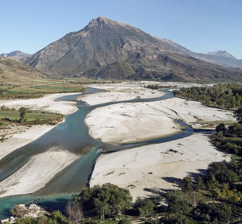
Sovinc A.: The Vjosa River in Albania – a new approach to protecting river ecosystems
Freshwater ecosystems - and rivers in particular - are among the most threatened in the world. Results from The Living Planet published by the WWF International analysis highlight a dramatic decline of 83% in species in freshwater ecosystems between 1970 and 2018. River ecosystems are particularly threatened in Europe, where - with the exception of perhaps the far north and east - there is virtually no longer a long river that is still entirely free-flowing.
Nevertheless, one such river was discovered by representatives of international and national NGOs in Albania some two decades ago: the Vjosa. Together with the efforts of local communities and major international actors and with the cooperation of the Albanian authorities, the Vjosa River has been protected as the Europe’s first ‘wild river’ national park since March 2023. The river is the best possible approximation of a European watercourse over 200 km long, uninterrupted by a single dam or hydro-power station throughout its course, and this is also true for the vast majority of its tributaries. The Vjosa River runs from its sources in Greece (where it is called the Aoos River) to its mouth in southern Albania, where it drains into the Adriatic Sea. Thus, the first 80 km are in Greece. The total catchment area covers 6,704 km2, of which 4,365 km2 lies in Albanian territory. The Vjosa River and its tributaries can be classified as a gravel-dominated, laterally active, anabranch rivers with high sediment yields, where the bedload supply is higher than the actual transport capacity of the channel. This is reflected, particularly in the middle section of the river, in extensive gravel plains up to 2,000 m wide, crossed by several lateral and parallel rovers, oxbows and side channels. Gravel bars are specific forms of break-off at high flow velocities, which is reflected in the rapid abandonment of the main river channel during extreme flood events, and the formation of a new, parallel river channels in former floodplains. The National Park, in the total length of 400 km, includes the main river and three tributaries (the Drino River with the tributary Kardhiq, Bënça, and Shushica), and the International Union for Conservation of Nature (IUCN) soon joined the partnership when a long-term management plan had already been under preparation. It is currently being adopted by the relevant national bodies. Similarly to many other protected areas worldwide, the Vjosa Wild River National Park faces challenge of tourism development.
Plesník J. & Hanel L.: Inland Water Ecosystems State and Outlook Worldwide
For humans, water is much more than just the chemical formula H2O. It remains a prerequisite for the existence of life on Earth. Even cosmologists searching for life beyond our planet use sophisticated probes to search for water, to which all known organisms are bound to a varying degree. It was once considered an inexhaustible natural resource, but this has not been the case. The state of the world’s inland waters is not favourable. Although climate variability is causing some changes in the water cycle as a whole, human intervention remains the main driver affecting inland aquatic ecosystems, mainly through pollution of aquatic ecosystems. Water abstraction, particularly for agriculture, is also a major influence. The diverse and increasing impact of human-induced external drivers on inland aquatic ecosystems has been known for decades, as well as the effective solutions to reduce or mitigate it, using both natural and technological approaches. Protecting, conserving and managing inland water ecosystems require surface water and groundwater be considered and managed as a single interconnected resource. In many cases, the application of an ecosystem approach, such as integrated river basin management or circular water management, is often effective. There is some hope that their application in practice can benefit from the current political support given to climate change mitigation and adaptation measures. ■
- - - -
The list of references is attached to the online version of the article at www.casopis.ochranaprirody cz.


